Distance: 27.3 miles
Elevation: +4890 -4830 feet
Running time: 5 hours 35 minutes
Transit time: 1 hour 10 minutes
Transit fare: $4.50 + $1.00 + $3.90 = $9.40
View on GaiaGPS →
Topping out at 3,848 feet, Mount Diablo is a stunning bit of nature in close proximity to the Bay Area, encroached upon from all sides by development. Save Mount Diablo is one of the organizations which works hard to make this possible. In the grand scheme of mountains, the elevation is pretty modest, but it only took me a couple runs there to appreciate that it's still more than enough to get yourself into a bit of trouble.
On top of that, precipitation on the West Coast has been pretty unusual this year. Weather in the Bay Area can be monotonous, so when I heard on Friday that parts of LA had received four feet of snow and then saw photos of snowcapped peaks visible from Downtown SF, I knew I couldn't miss the opportunity.
Lacking the motivation to tackle a route that had really kicked my butt in the past, I thought I'd utilize the County Connection bus system to cut the planned distance from about 26 miles down to 20. It didn't work out, but we got home safely.
12th Street Oakland
I left home at about 10:50 AM; a late start, but with the sun setting at about 6 PM now, I hoped to finish before the sun set—though I brought a headlamp just in case.
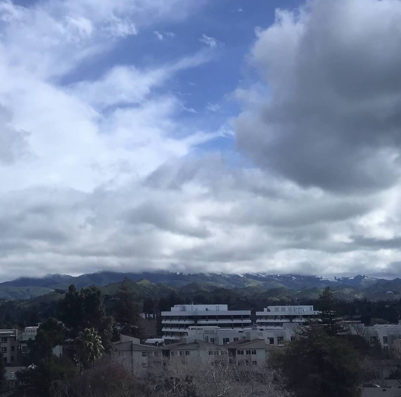
The weather looked promising as the train passed through Walnut Creek, though with the mountain covered in clouds, it was hard to tell just how much snow might still be on top.
Concord Station → 320 County Connection
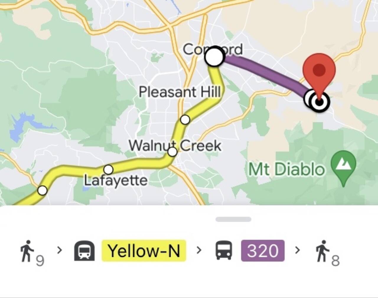
I'd planned to take the bus and cut off five miles of running along a four-lane highway, but Google had other plans. The purple line above shows the 310 County Connection route from Concord to Clayton, incorrectly labeled as the 320 route. The 320, it turns out, goes in the opposite direction before eventually returning to the BART station. From what I can tell, Google is completely incorrect here.
320 County Connection → Bail 🤦🏻♂️
I realized quickly enough that I was on the wrong bus, but returning to the BART station, was left with the choice to either wait an hour for the correct bus or just run the now five and a half miles to Clayton. I opted to run.
There's not much to say about this five mile stretch from Concord to Clayton. There are endless stoplight crossings and even a road halfway between the cities called "Claycord Avenue," which feels like the sort of direct portmanteau you go with when there's just nothing of substance to say about the area.
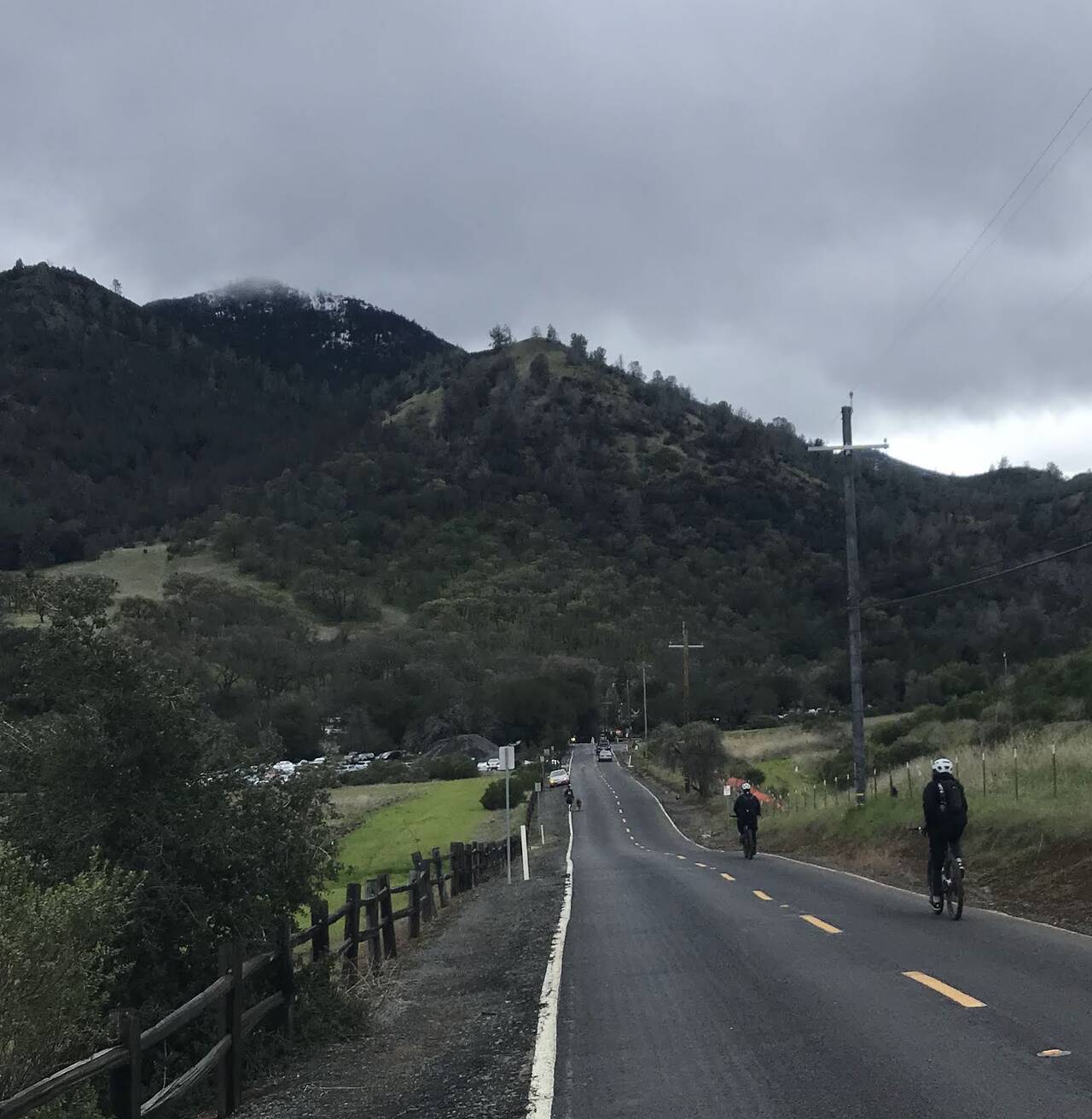
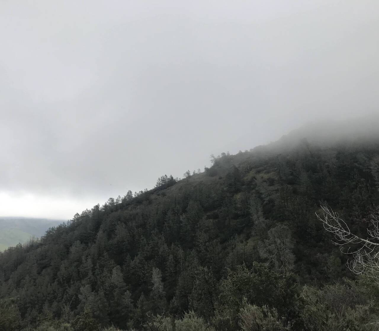
A fair amount of traffic near the Mitchell Canyon parking lot suggested I wasn't the only person seizing the opportunity to experience rare winter conditions in the Bay Area.
Mount Diablo State Park
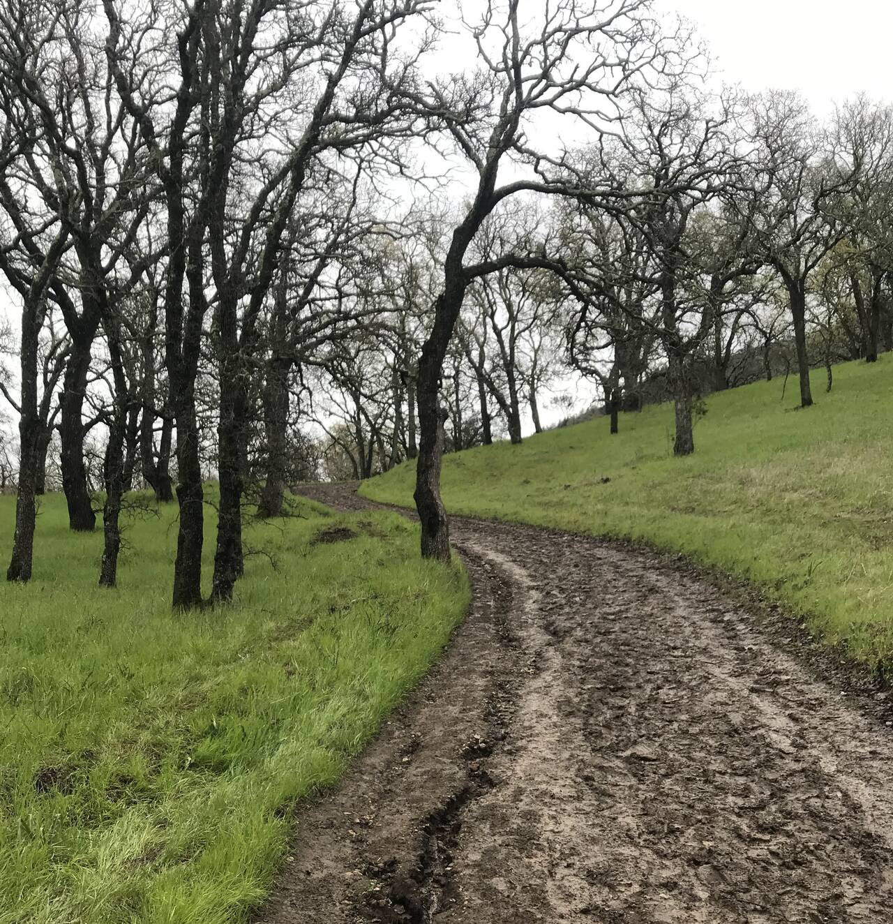
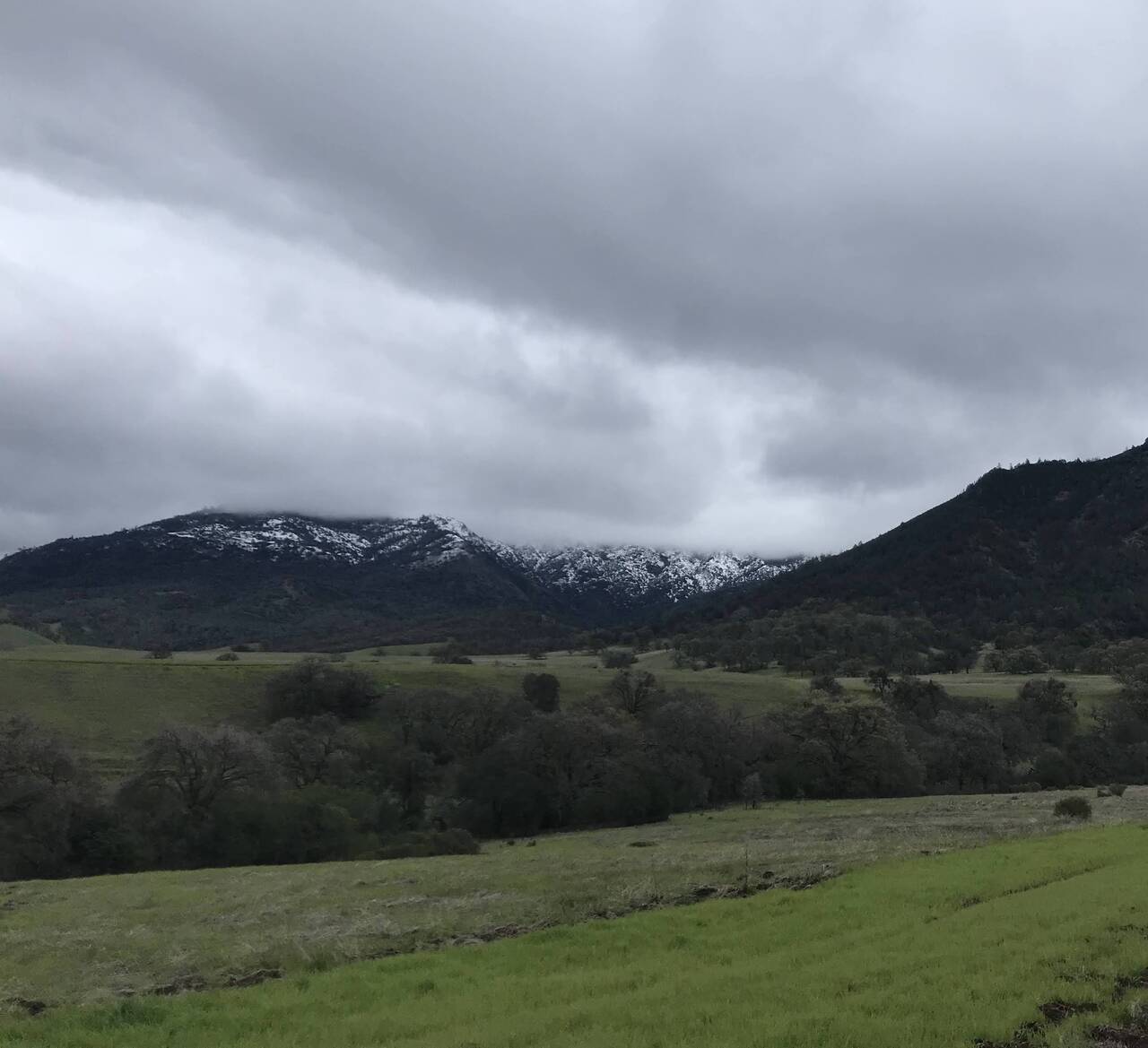
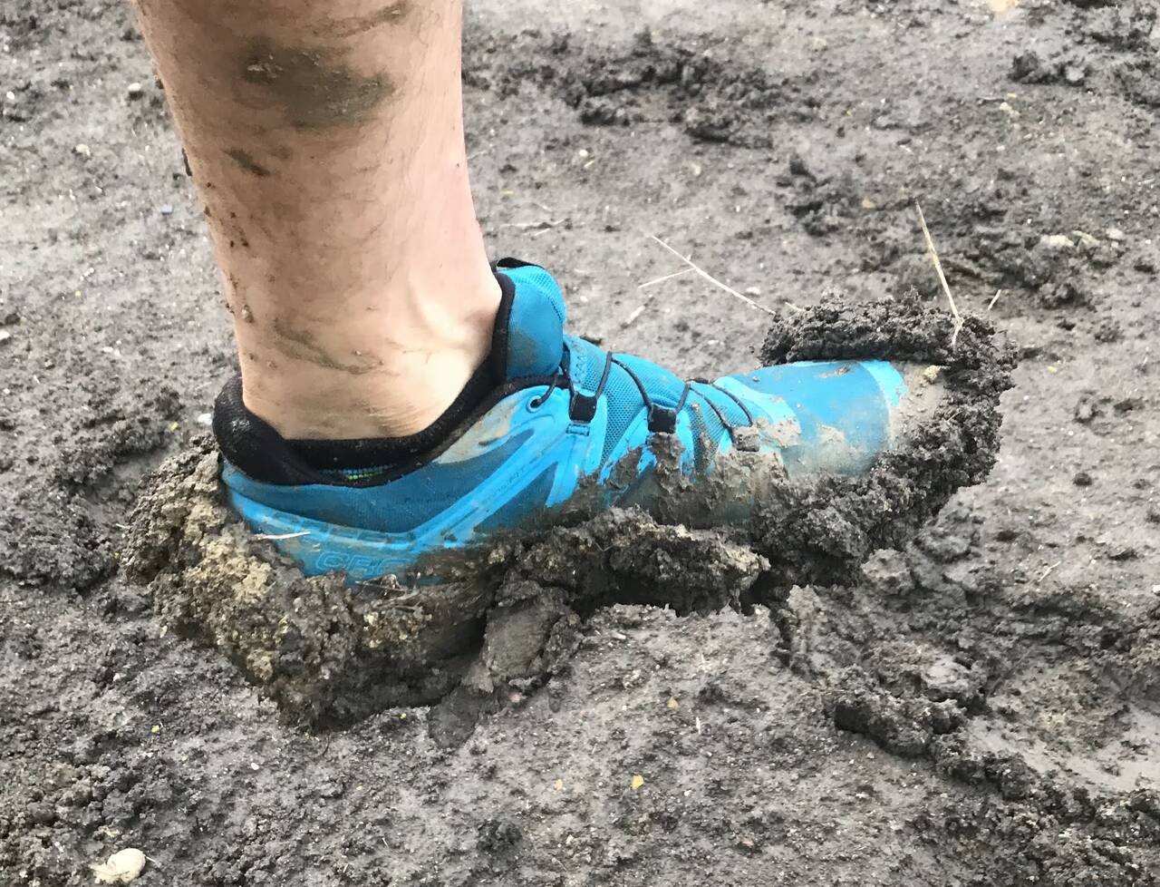
A rough start. Summer is often too warm for Mount Diablo, but winter carries the risk of glue-like mud which makes progress extremely slow.
Off of the main trail, the footing on the Mitchell Rock trail was quite good.
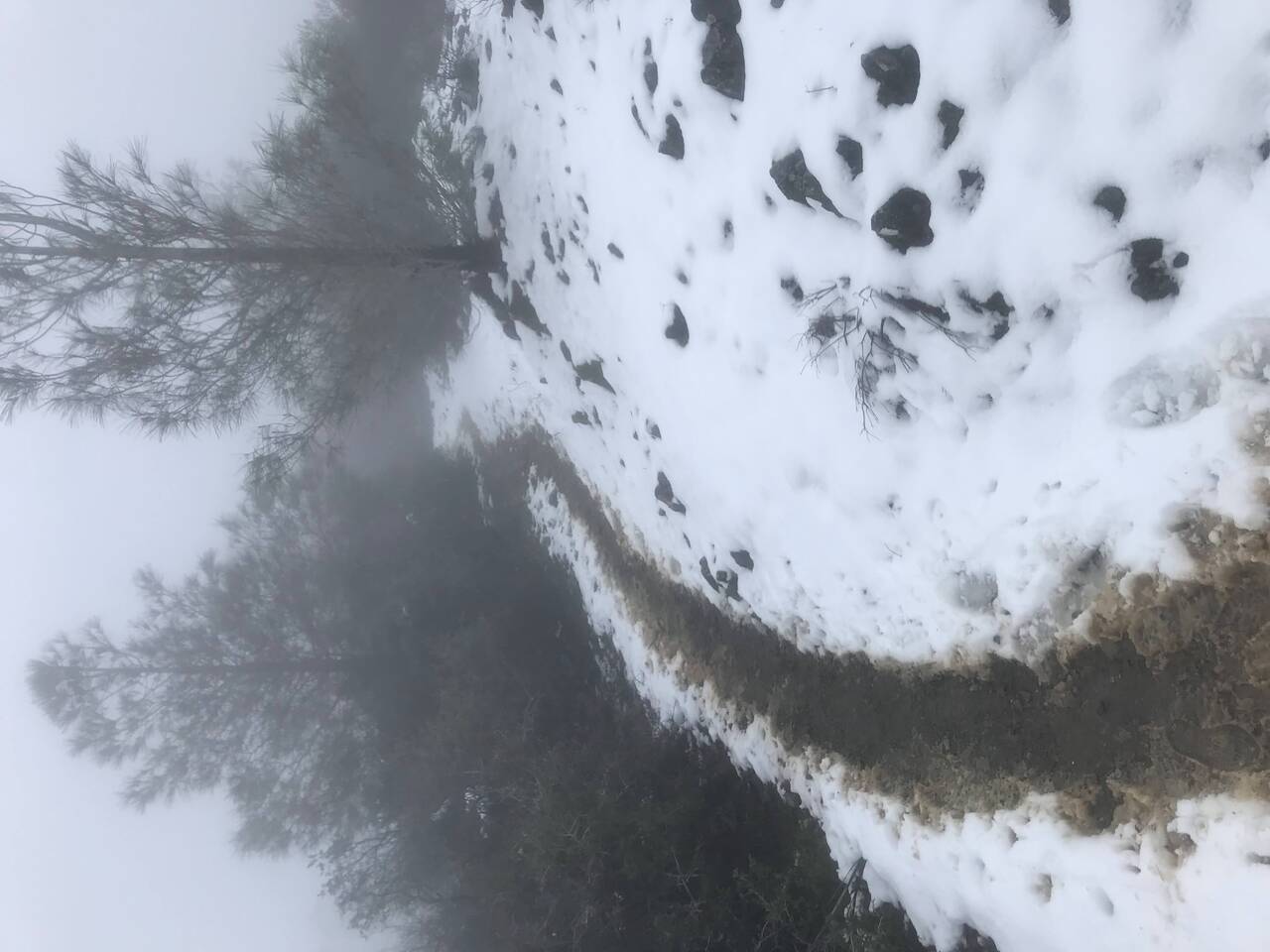
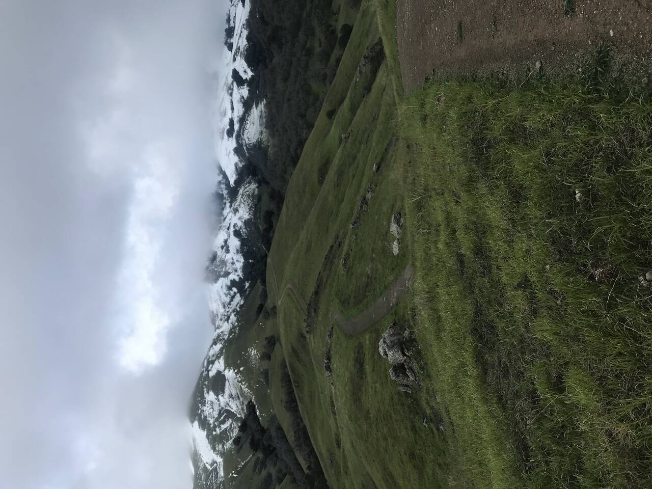
Dirt eventually gave way to snow, though the footing remained pretty good. Progress was pleasantly quick.
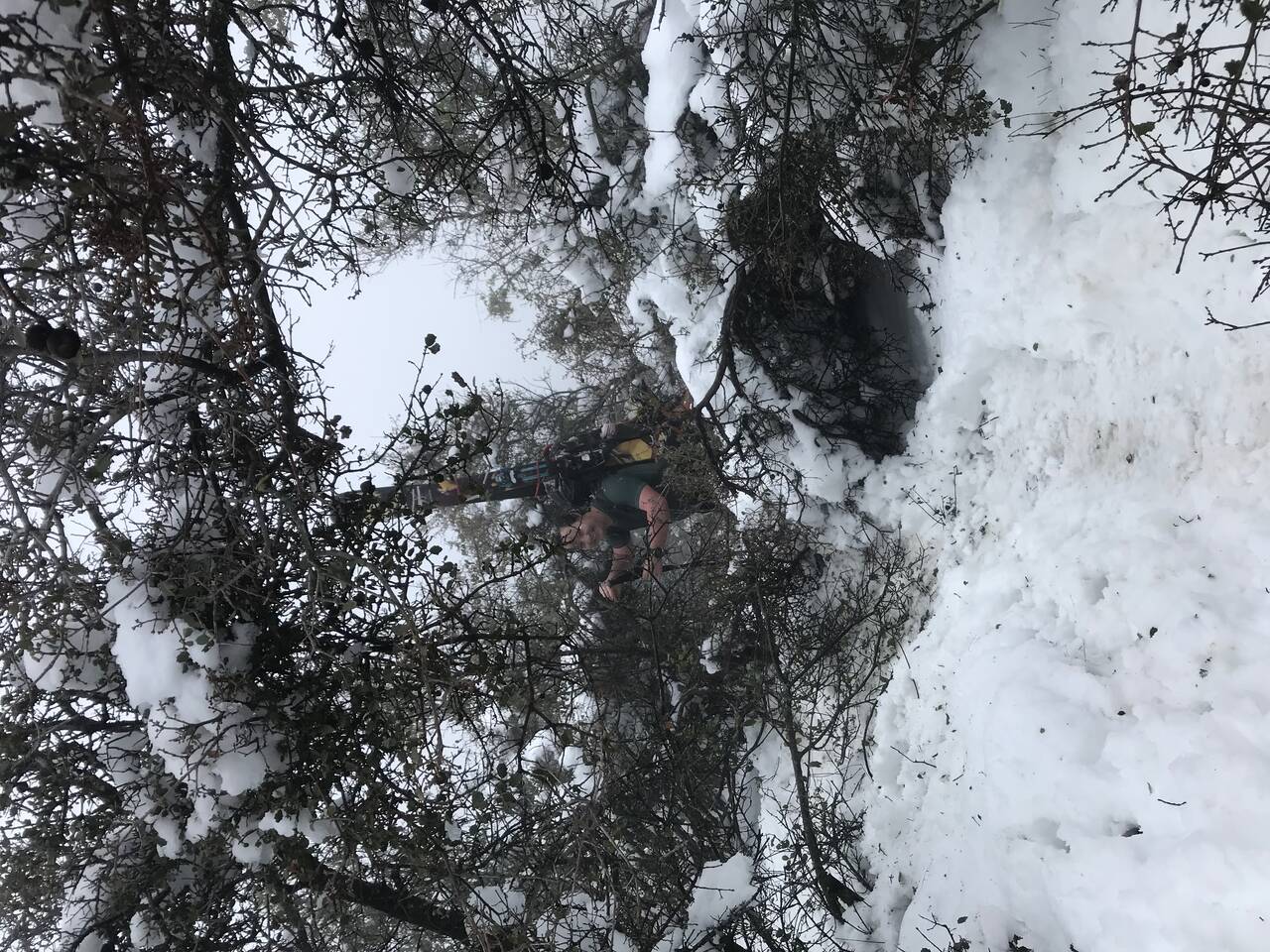
As conditions grew more wintry, I was amused to start seeing more skiers than hikers. I chatted with a skier as he crawled through ice-laden brush and fallen trees. I asked if I could snap a picture. He was in good spirits, but I think we both understood what a rough time he was having.
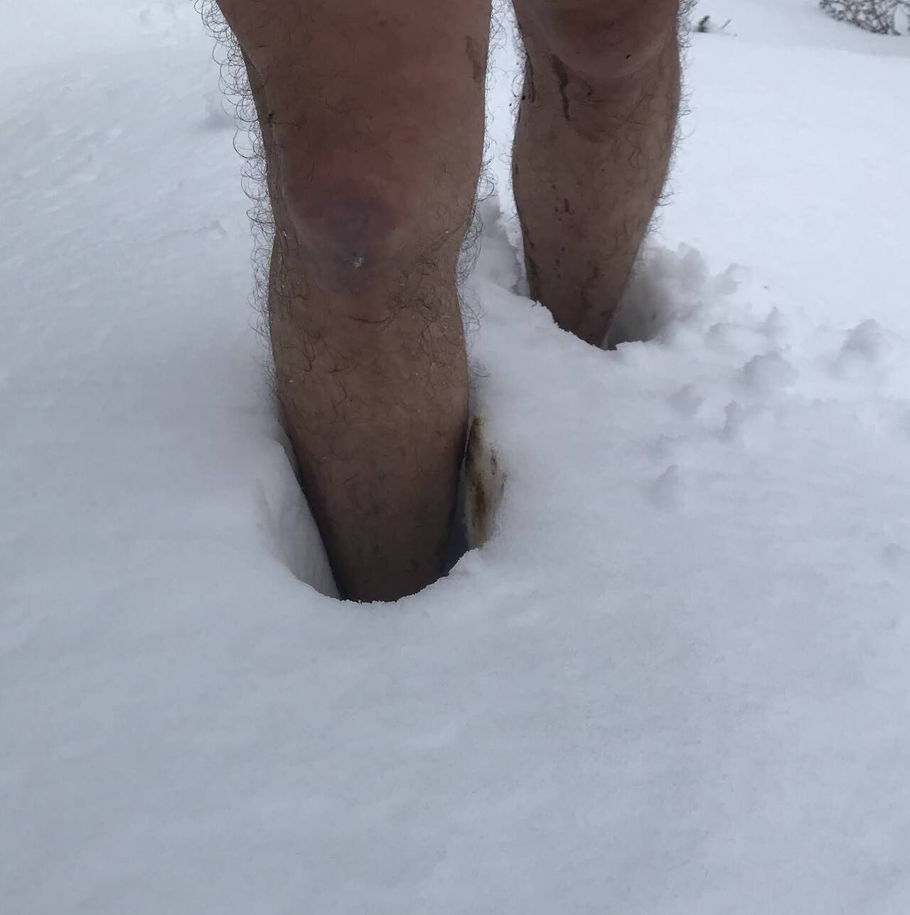
The direct trail to the summit of Mount Diablo is steep and difficult in the best of conditions. It wasn't quite postholing, but the snow was heavy and deep and my only company was a pair of ski tracks winding up the hill.
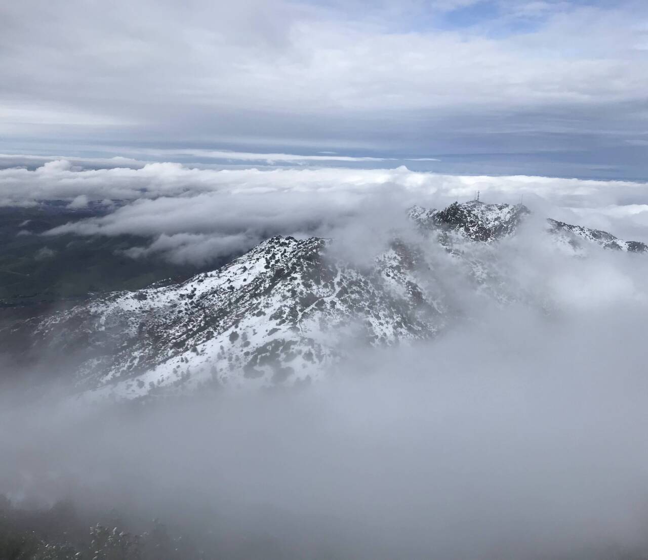
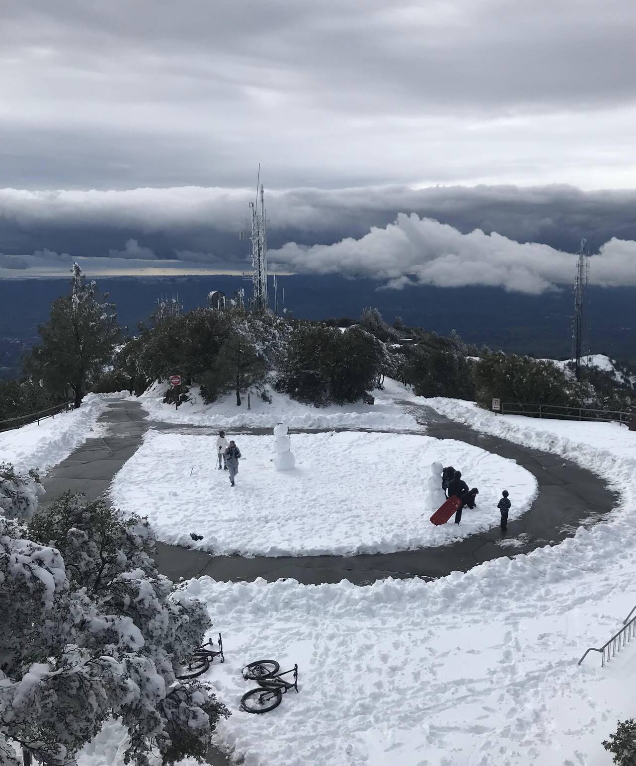
The summit was a nice little winter wonderland. The road was closed at Juniper Campground so that I was surprised how many people had hiked to the summit.
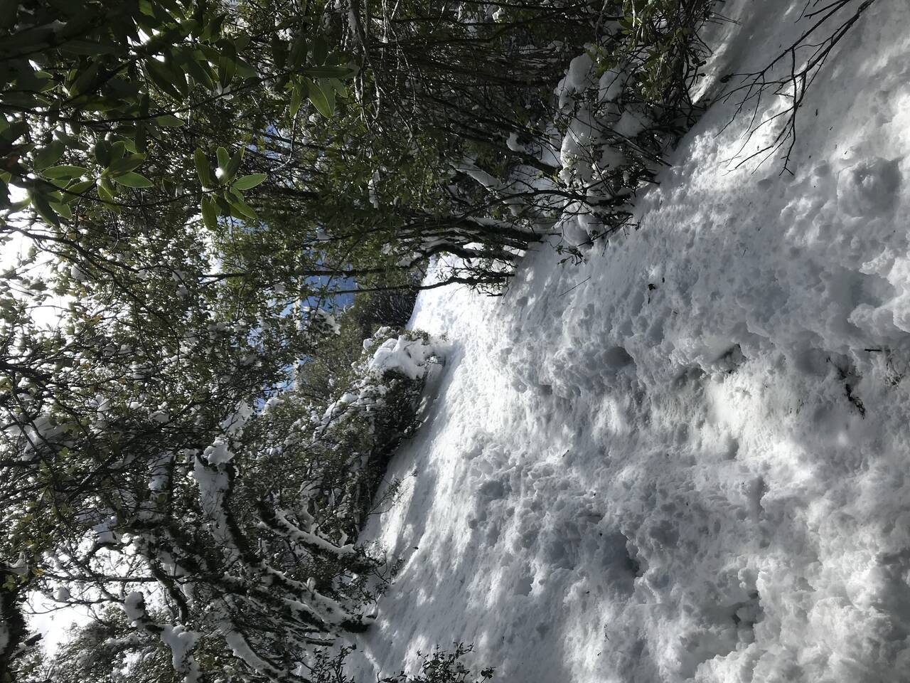
I was having so much fun running and glissading down the hill that I forgot to pay attention to where I was going. After a couple wrong turns, I got on the right trail and began the descent.
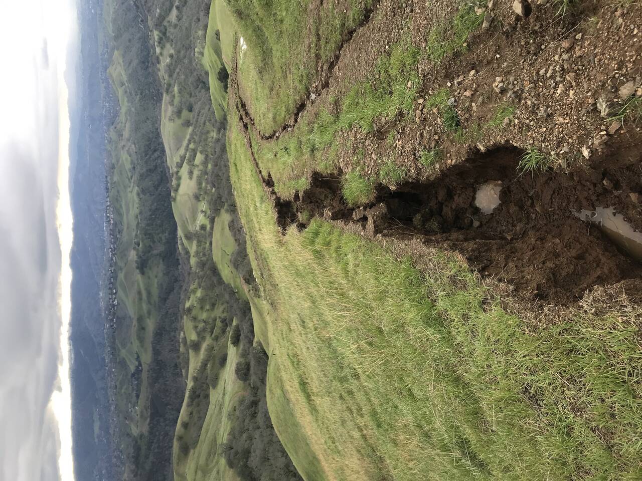
Recent storms significantly damaged the trail. I imagine we're only perhaps thirty or forty years into these trails receiving heavy foot traffic. I wonder what it will take to maintain them for even just another generation or two.
As often happens, I was tired enough at this point that a long descent didn't bring the sort of relief I'd hoped.
I knew there were were a number of creek crossings ahead, so I opted to take a different route that passed by the climbing area, but found the entire area closed for raptor nesting.
Diablo Foothills Regional Park
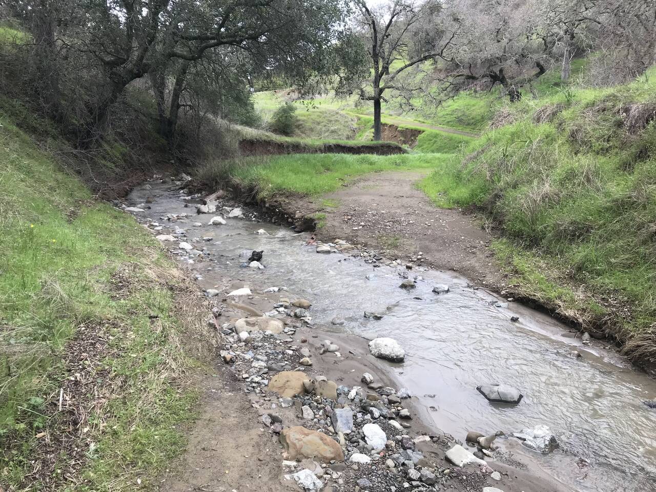
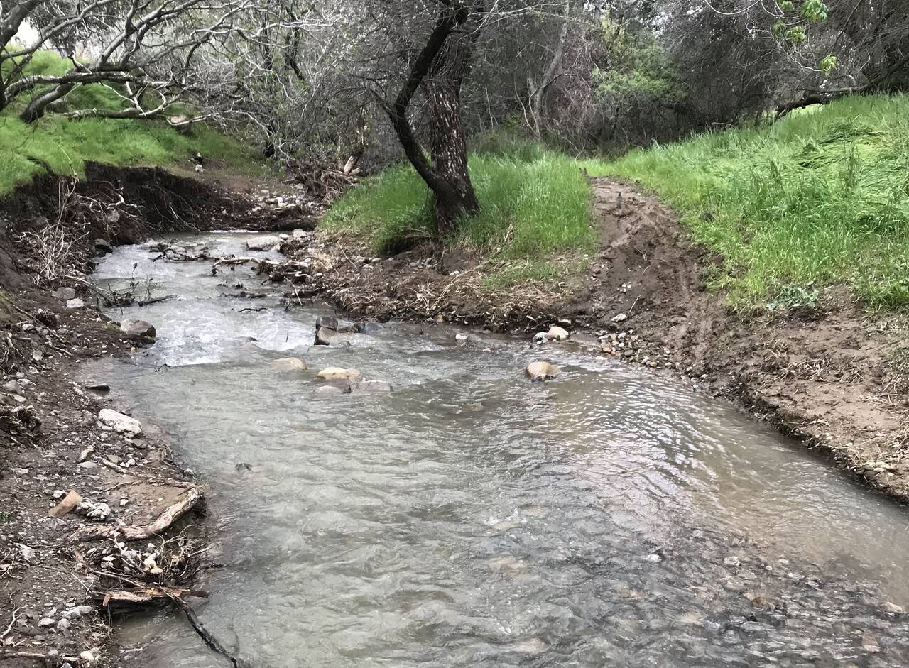
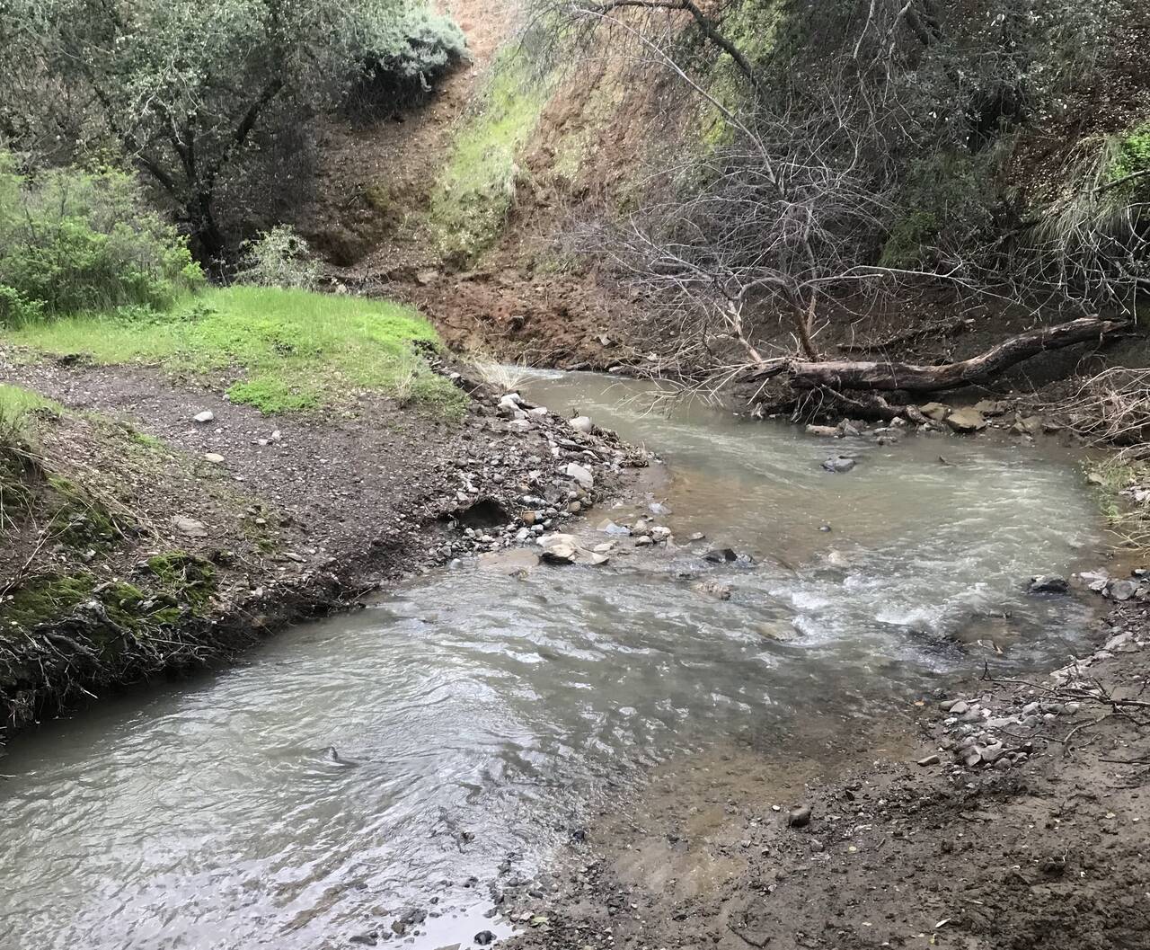
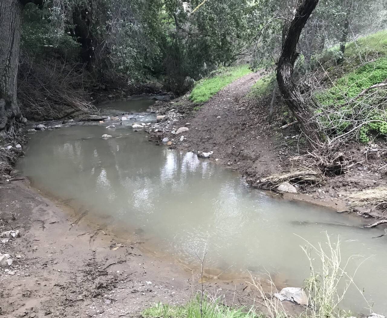
There were at least four crossings in short succession of the same creek. As I scrambled up a hillside out of the last crossing, I firmly grabbed what I realized was poison oak. We'll see how that goes in the next day or two.
Update: AHHHHHHHH it itches.
Shell Ridge Open Space
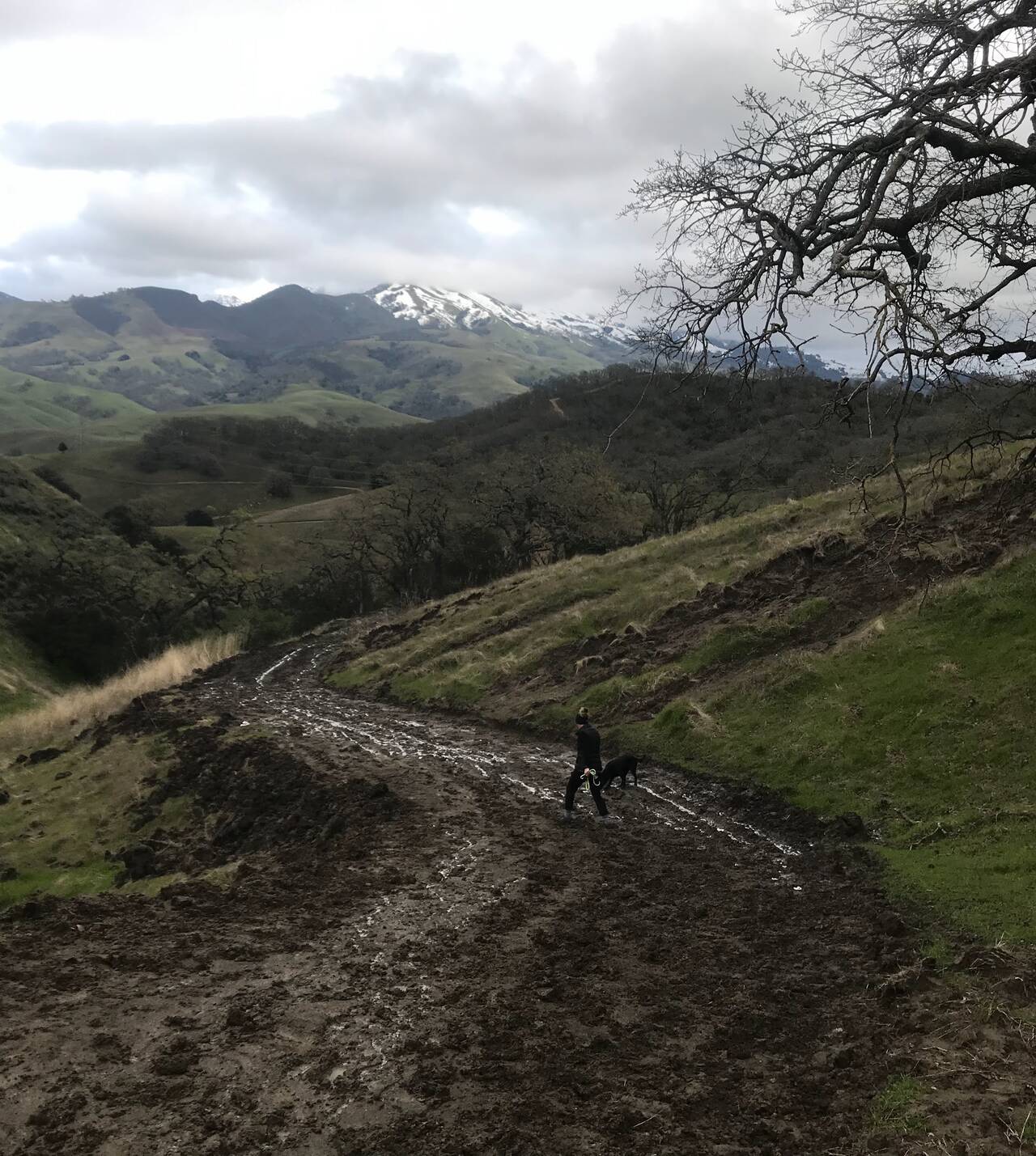
A series of lovely parks takes you most the distance back to downtown Walnut Creek without having to run along roads. Unfortunately, there are a few sections that are awful in the winter when the mud turns to glue. Feeling heavy enough already, I didn't need an actual few pounds extra on my feet.
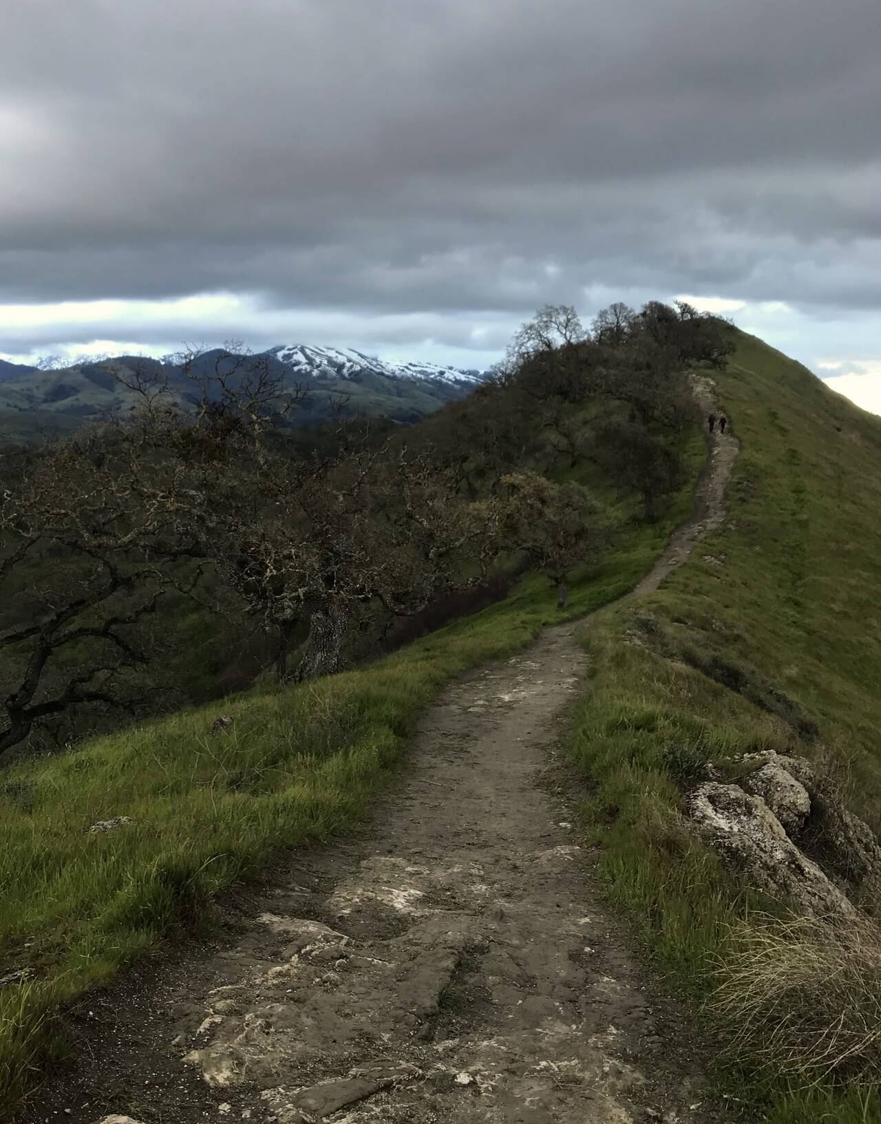
Once past the mud, the trail hops along the ridge all the way back to downtown Walnut Creek. I kept looking back to catch one more glimpse of a a snow-covered Mount Diablo.
Walnut Creek
The last two miles was pretty unremarkable. It certainly wasn't pleasant, but it wasn't the worst run I've had here. I was disappointed to see from the BART station that I'd arrived maybe thirty minutes too early to see the hills turn a brilliant red as the sun finally set. But I was on my way home.
12th Street Oakland
As difficult as it was to get myself out the door, I'm glad I didn't miss the opportunity. I'd consider it a success even though it was closer to a slow trudge than a run. And I certainly learned a few lessons. Don't trust Google when it comes to buses. No one outside the Bay Area is impressed by one foot of snow. Pay attention to where you're going and don't get lured in by glissading.
Mitchell Canyon is certainly my favorite trailhead. The trail goes right up the ridge exactly like you hope it will. The lush green hills of the west side of the are worth a trip as well. There are more than enough trailheads to go as far as you'd like, and it's absolutely worth the trip if all you do is drive to the summit. Just be careful that the low trails and surrounding parks might be particularly muddy in the winter and hot in the summer.
☃️