Distance: 40.4 miles
Elevation: +6850 -6850 feet
Running time: 7 hours 10 minutes
Transit time: 1 hour 50 minutes
Transit fare: $3.85 + $8.00 + $3.85 = $15.70
View on GaiaGPS →
Golden Gate National Recreation Area manages about 128 square miles of parks, stretching all the way from Palo Alto up to Tomales Bay. Together with Mount Tam State Park, Marin Watershed District, and Point Reyes National Seashore, the parks contain enough trails to keep most runners busy for a while.
It's ironic then that although crossing the Golden Gate Bridge into the Marin Headlands was the very first trail I ran in the Bay Area, this was only second time I've repeated this segment, I think for no other reason than because sticking to the East Bay spares me a few minutes of commuting.
Anticipating that I'd enjoy the Super Bowl more in a post-long-run stupor, dog on lap, struggling to process the world around me, I decided to catch a mid-morning bus to Sausalito, aim for Stinson Beach, and see if I could get myself home. So I covered myself in sunscreen, threw seven energy gels and a banana into a small backpack, and headed out the door.
Lake Merritt Station
I've learned the hard way to check transit schedules on weekends. So I arrived at Lake Merritt Station at 7:29 AM and was pleased to wait only six minutes for a slightly-delayed train to Civic Center.
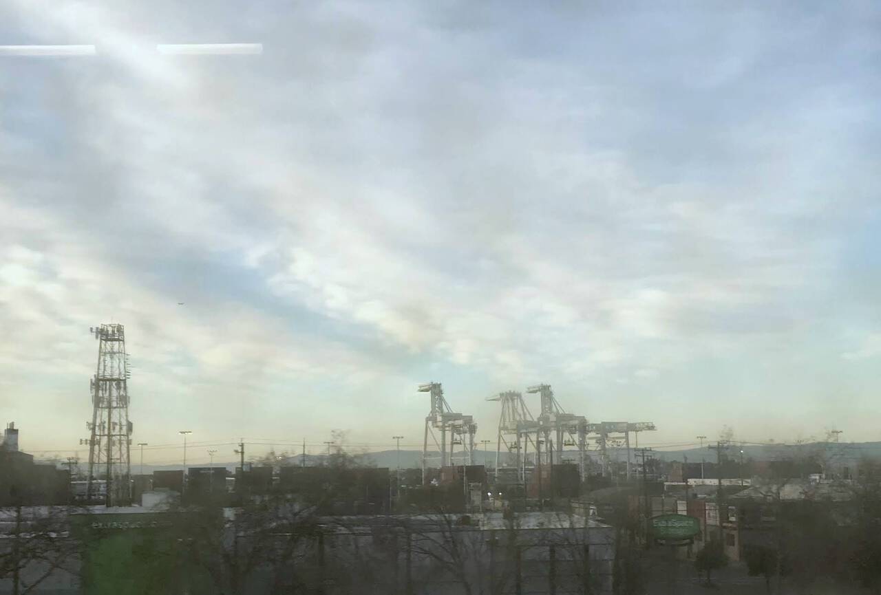
The morning began with a familiar view for East Bay commuters. Legend has it that the container cranes of the Port of Oakland inspired the AT-AT walkers in The Empire Strikes Back. George Lucas has called this a myth, but I like to let myself believe it.
Civic Center
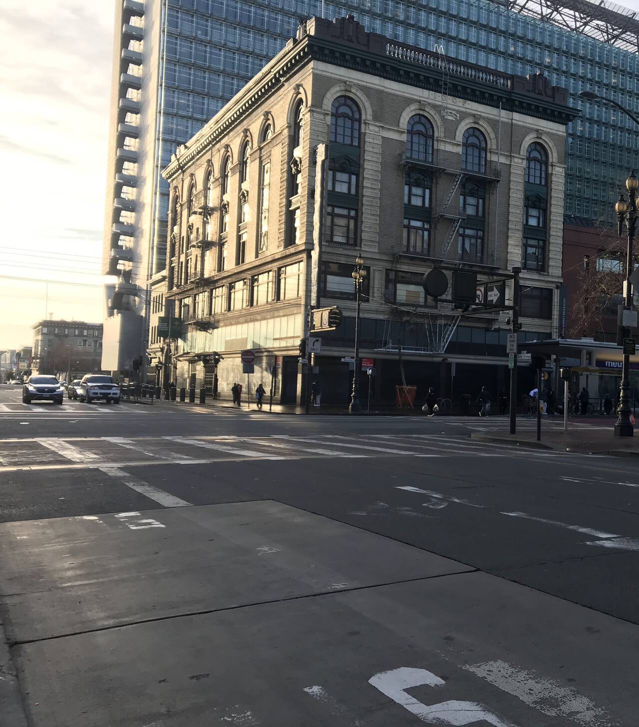
It's hard to live in San Francisco and not grow numb to things which would otherwise be at least mildly surprising. So it was as I waited at Civic Center for the 130 bus to Sausalito, looking cold in my running shorts. Across the street, a man climbed a sign post and waved his shirt at buses like a matador. At the BART entrance, a crowd of onlookers surrounded an all-out rolling-on-the-ground brawl. I was eager for the bus to arrive.
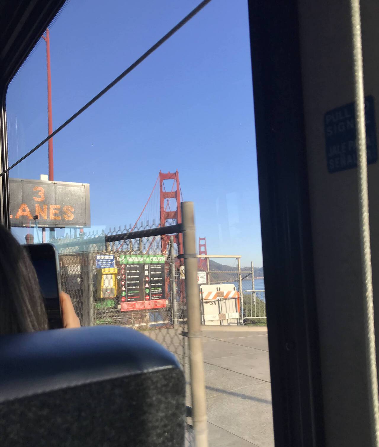
A bus full of eager tourists and one eager runner took many photos of questionable value as we crossed the Golden Gate Bridge.
Sausalito
I planned to stay on the bus longer, but to put it delicately, I was well hydrated. The bus paused in front of a public restroom, during which time I decided to hop off, thus beginning my run and adding a mile and a half to an already long day.
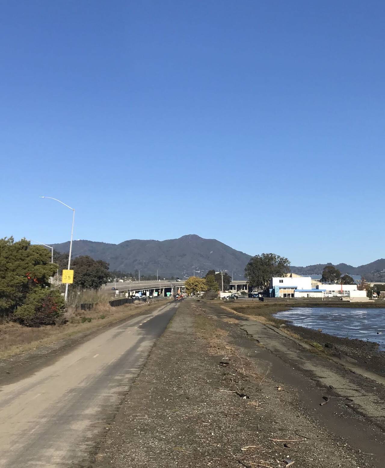
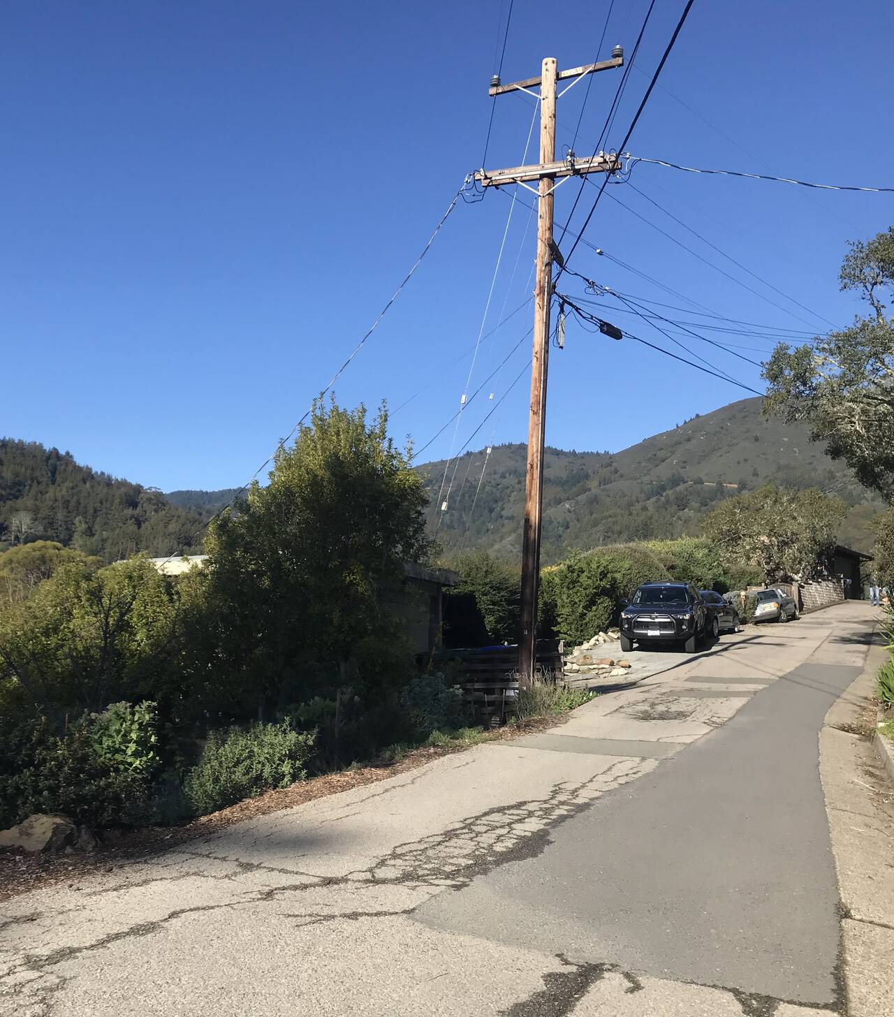
The path was perfectly flat and pleasant, dotted with cyclists, strollers and dogs. Mount Tam loomed on the horizon.
Uneasy about the second half of the route, I second-guessed my electrolyte supply and hopped into a Safeway for some Lay's Potato Chips and a Gatorade.
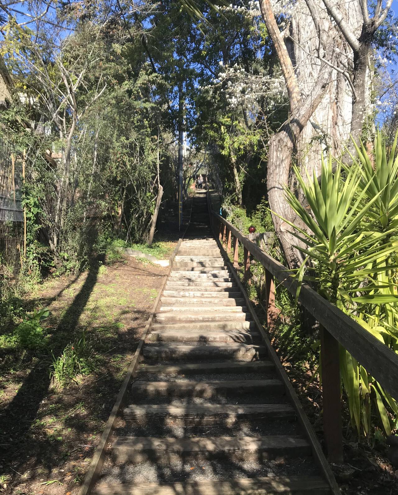
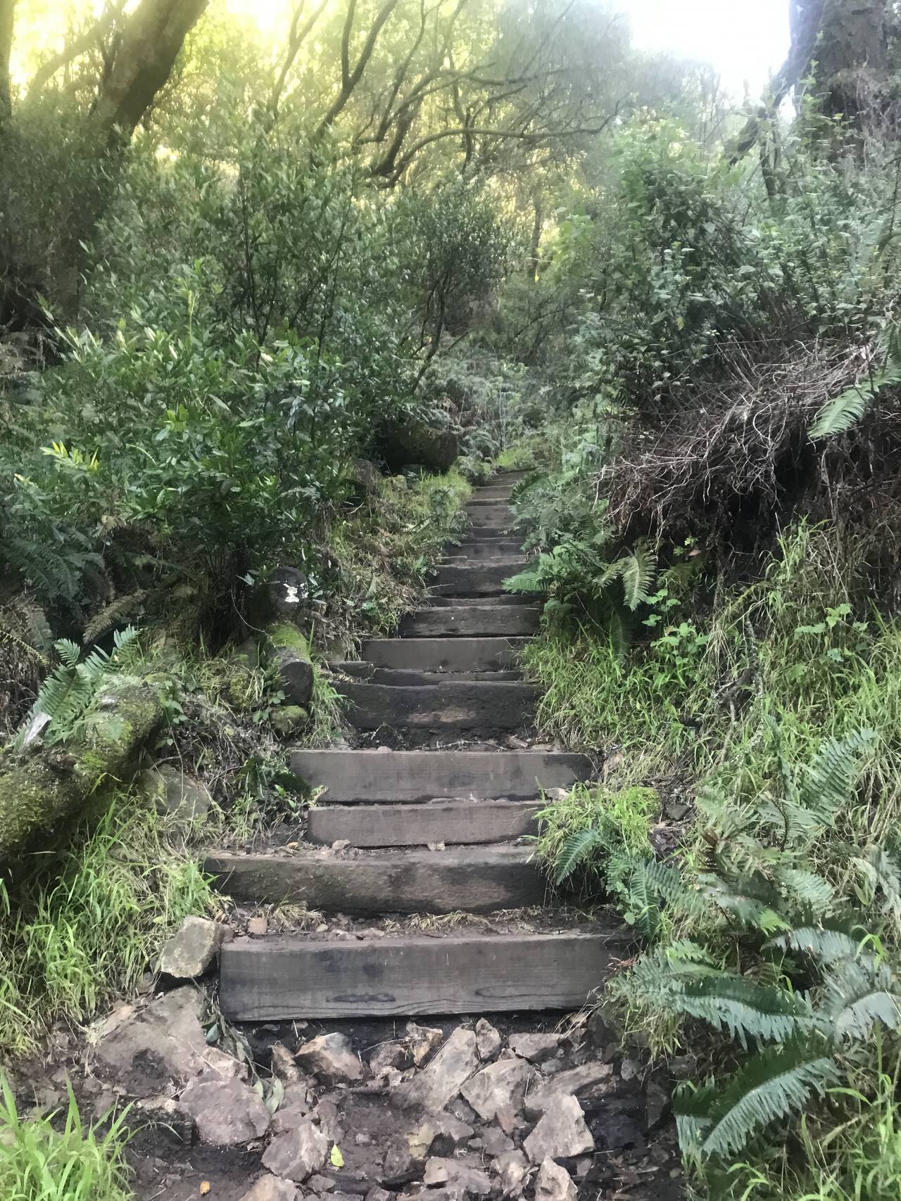
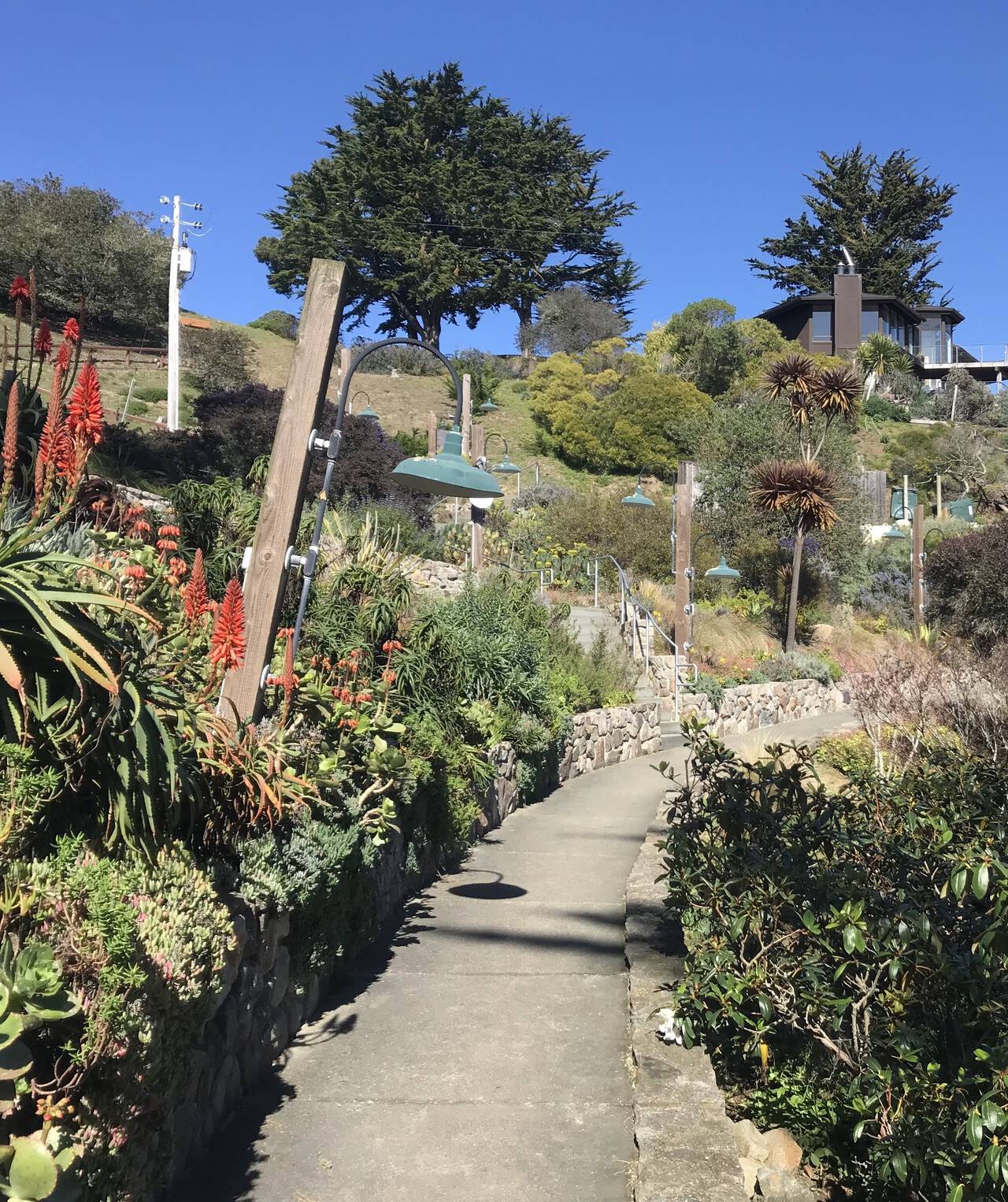
Just beyond the cafes of Mill Valley, a pleasantly-shaded stairway signaled the beginning of the hills.
The roads out of Mill Valley gained significant elevation before arriving at the trail, though the slope was gentle.
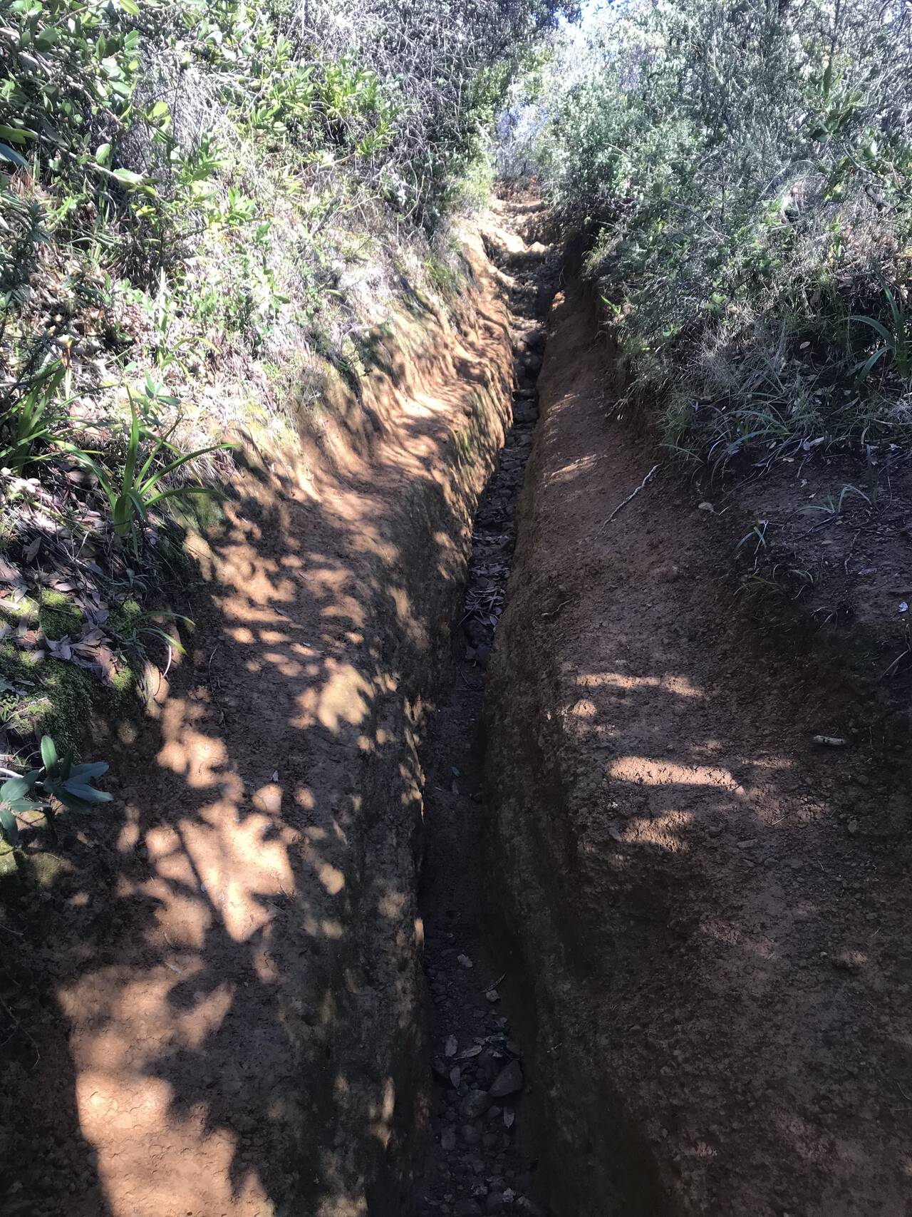
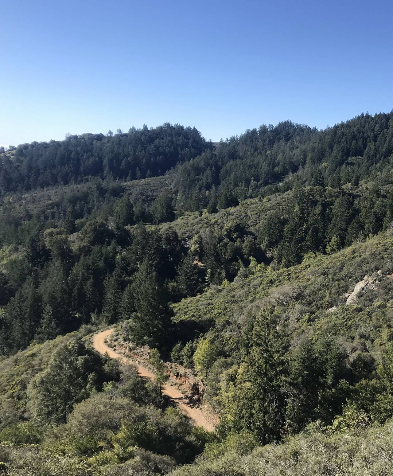
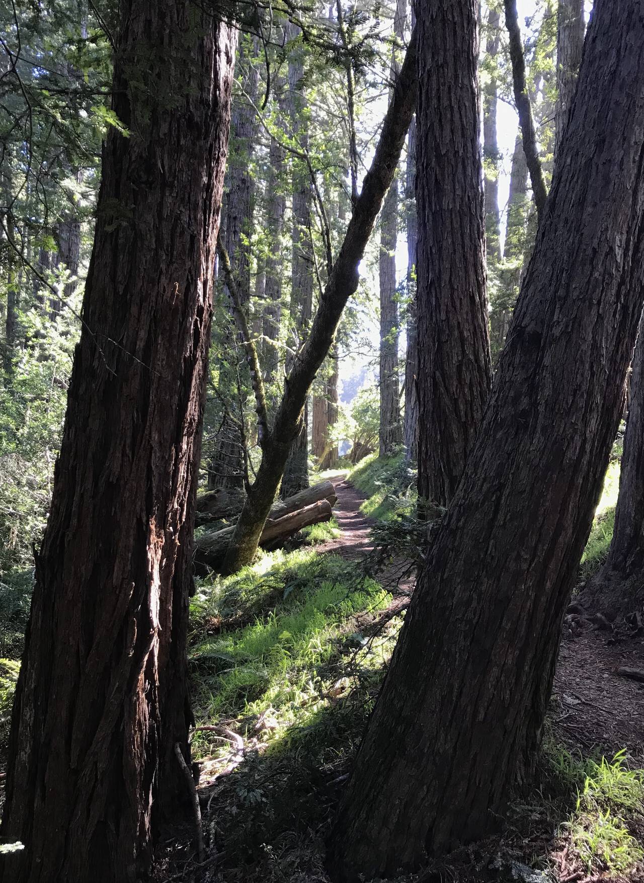
The bottom of the Temelpa Trail was washed out and rutted, though the upper trail was quite runnable, with good footing and abundant switchbacks.
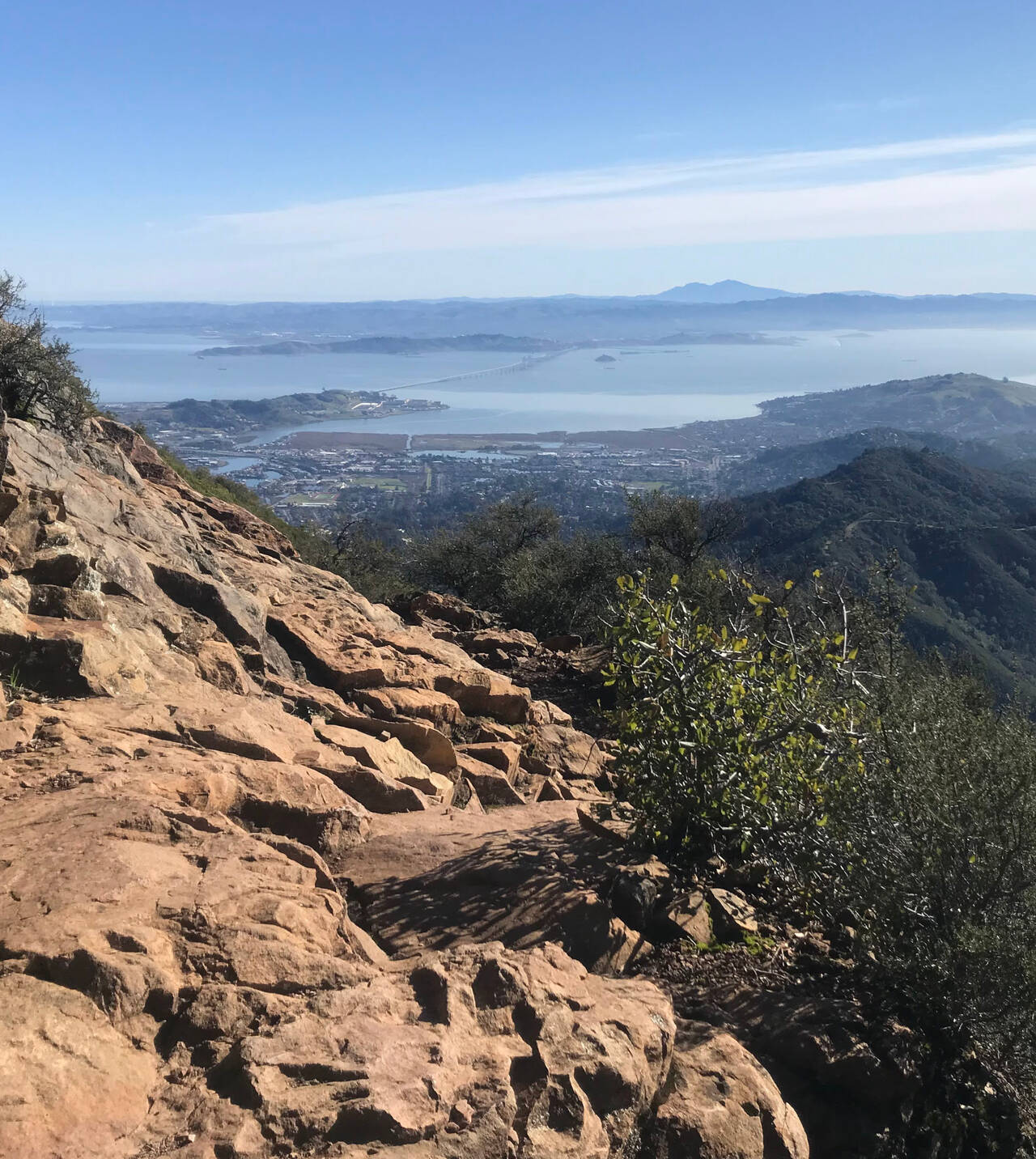
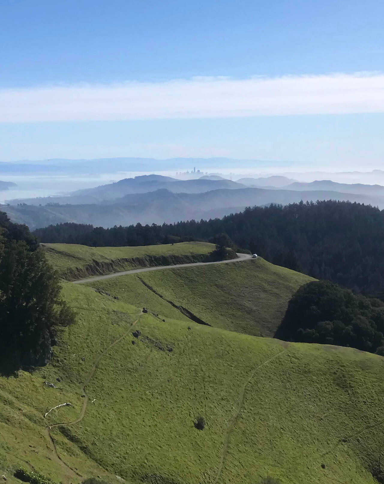
A rocky section and the first sweeping views of the Bay Area hinted that the top was already close.
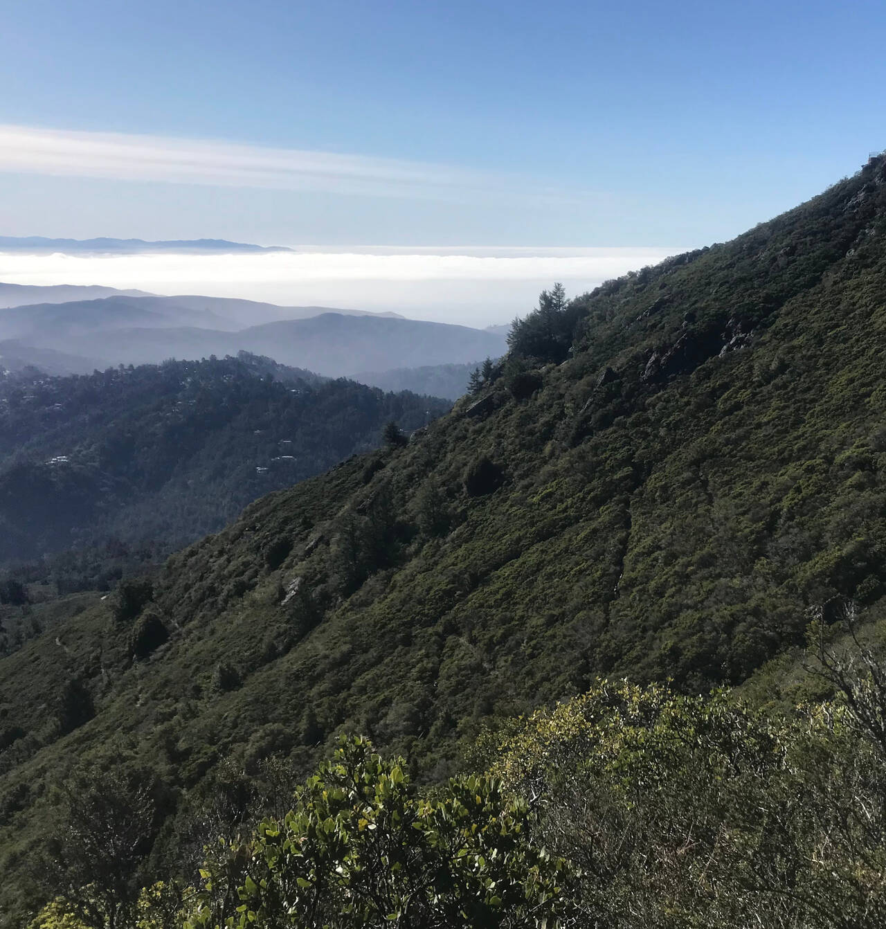
Looking back, hikers advanced steadily up the switchbacks.
Just eight miles in, the East Peak of Mount Tam marked an early high point for the day.
Did you know the West Point Inn is a hotel on Mount Tam which can only be reached on foot? I didn't.
The west side of Mount Tam felt rugged and remote as homes and paved roads momentarily faded from view.
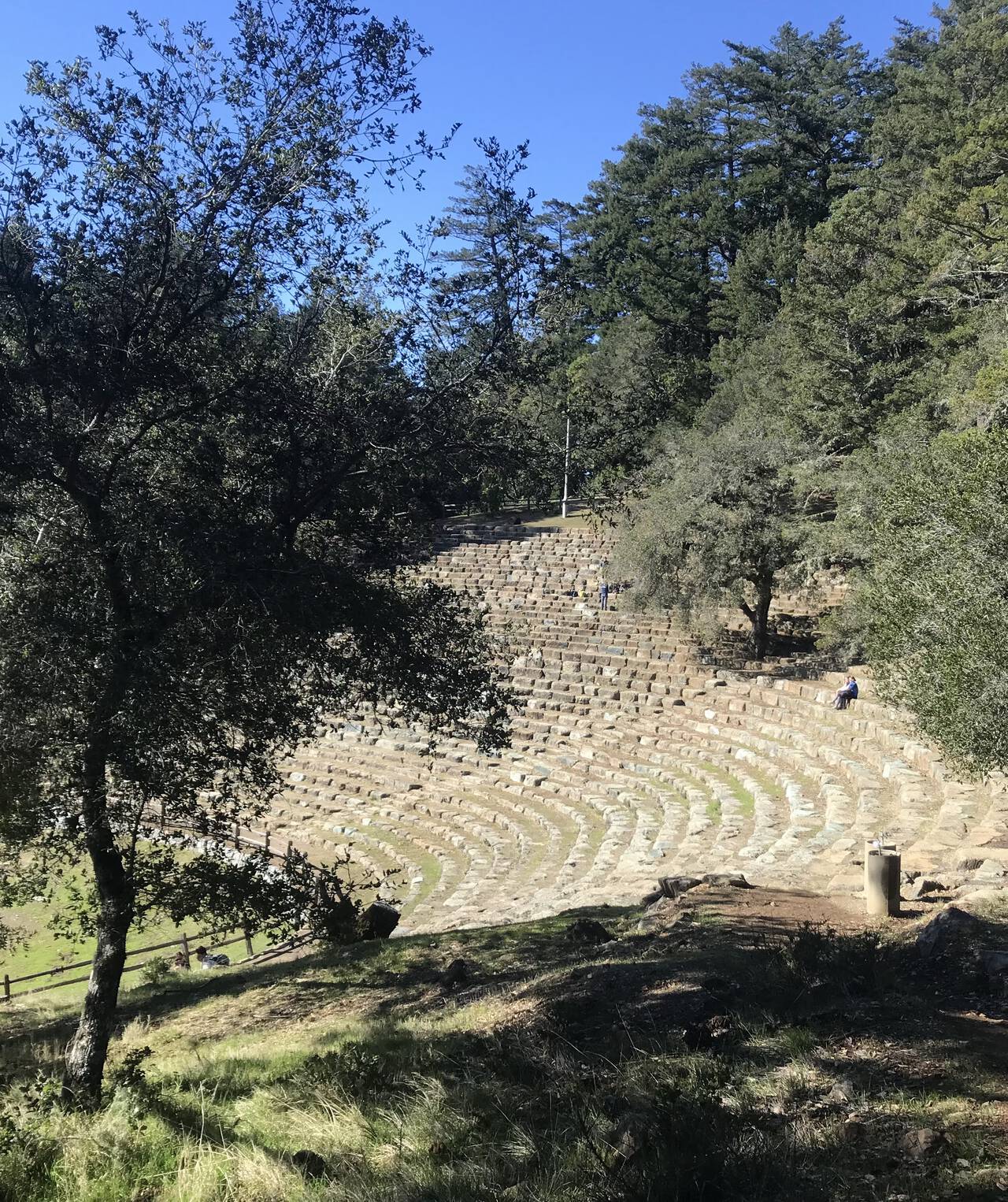
Signs of civilization quickly returned, though it's difficult to imagine the Mountain Theater filled with people. Relieved to see a water fountain, I drank and refilled a bottle.
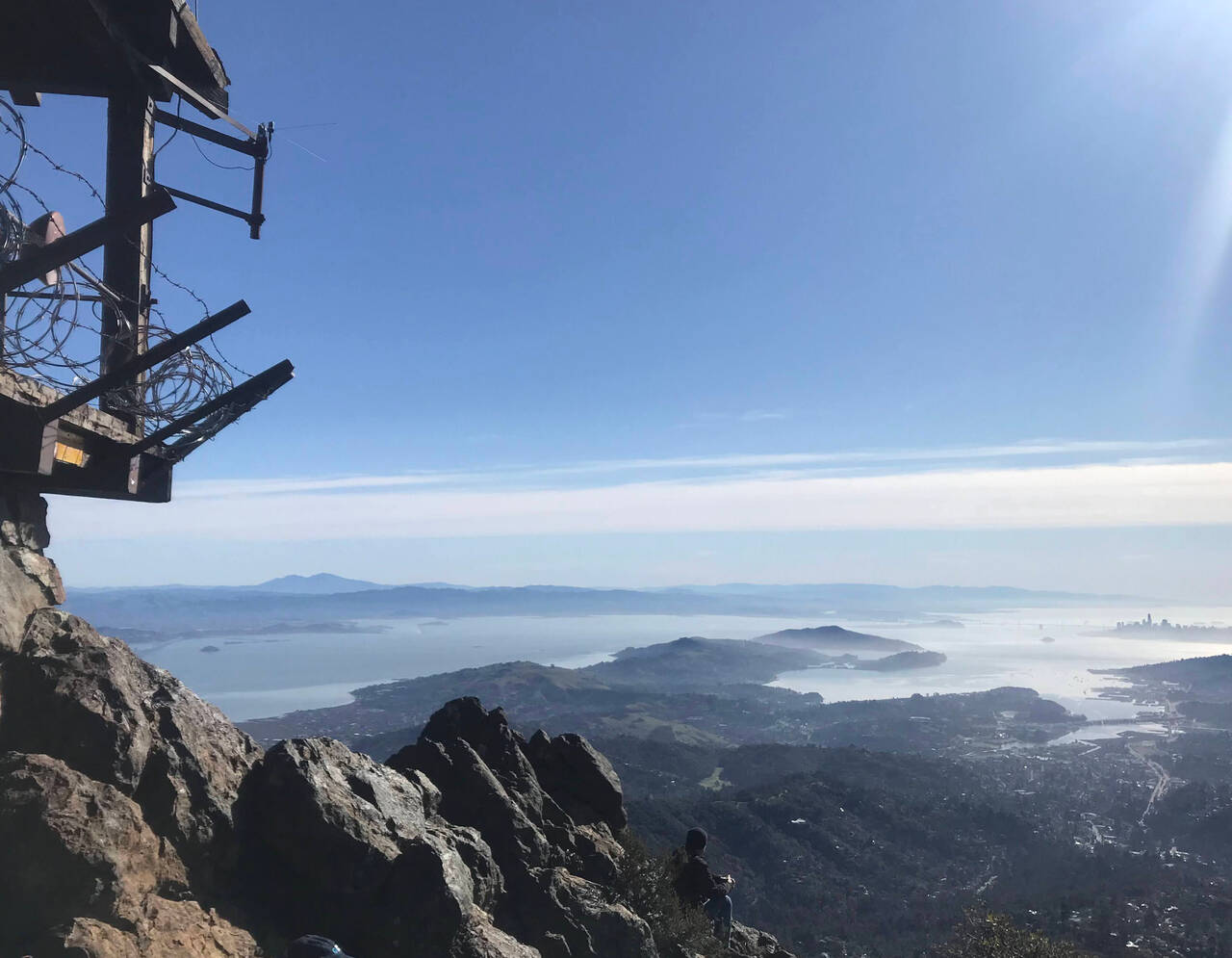
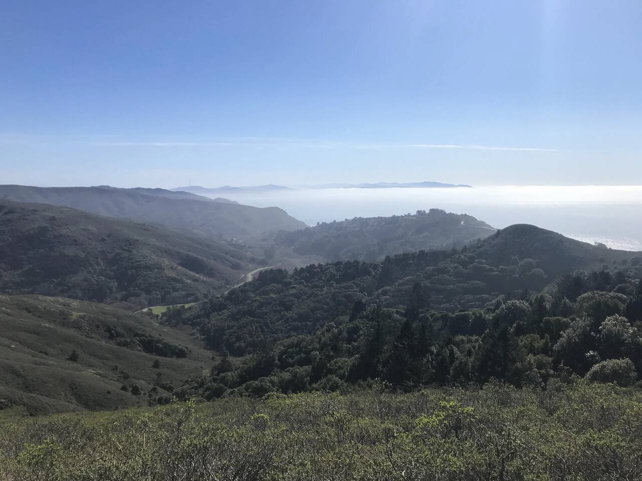
Exiting the forest, a cluster of skyscrapers was barely visible on the horizon. Nearby, a sign: "San Francisco - 21 miles." Confident the trail ahead wasn't any shorter than the road, the scale of the day's task became clear.
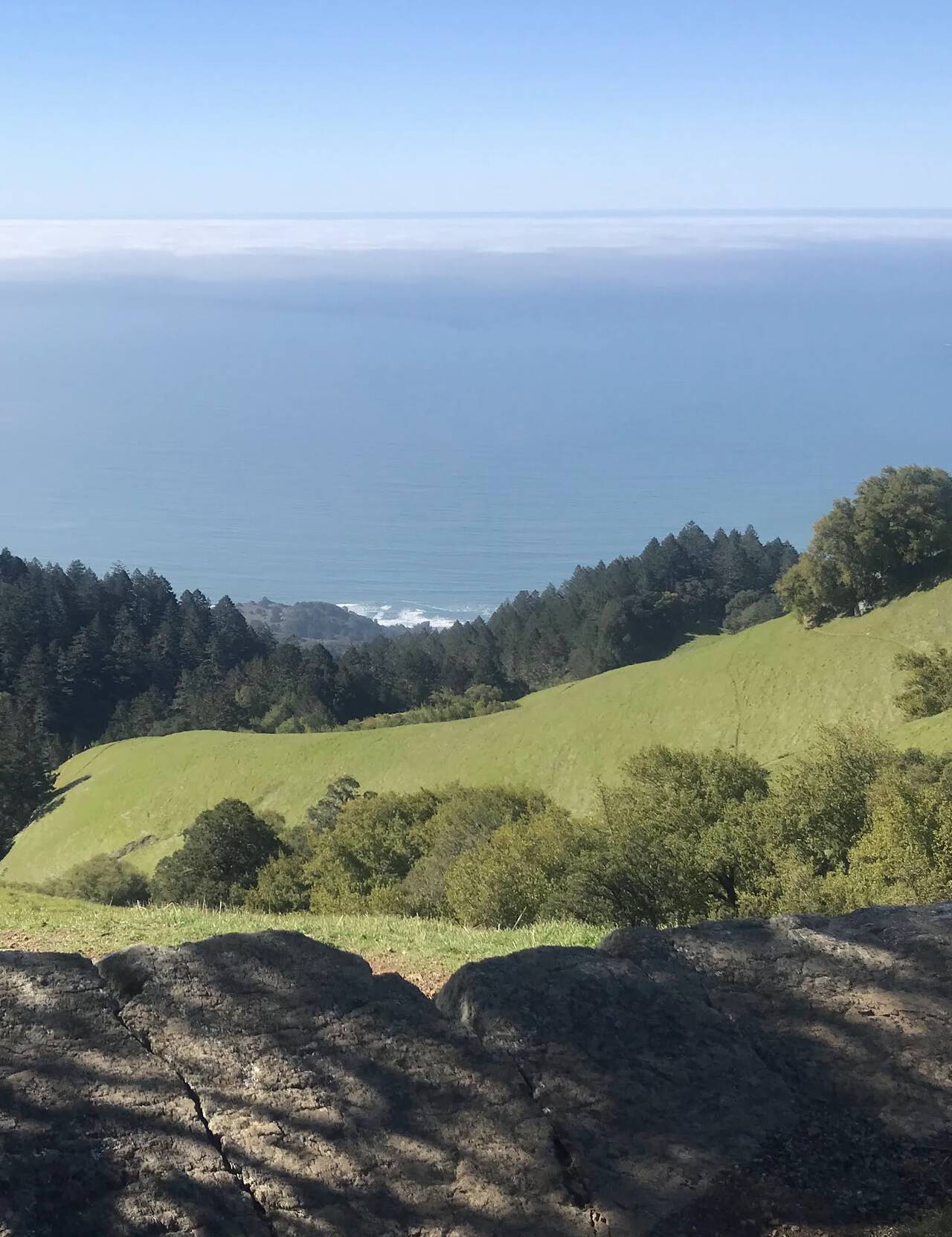
Still, the rush of looking 2,000 feet down onto lush evergreens and tropical ocean blue propelled me down the hill with energy to spare.
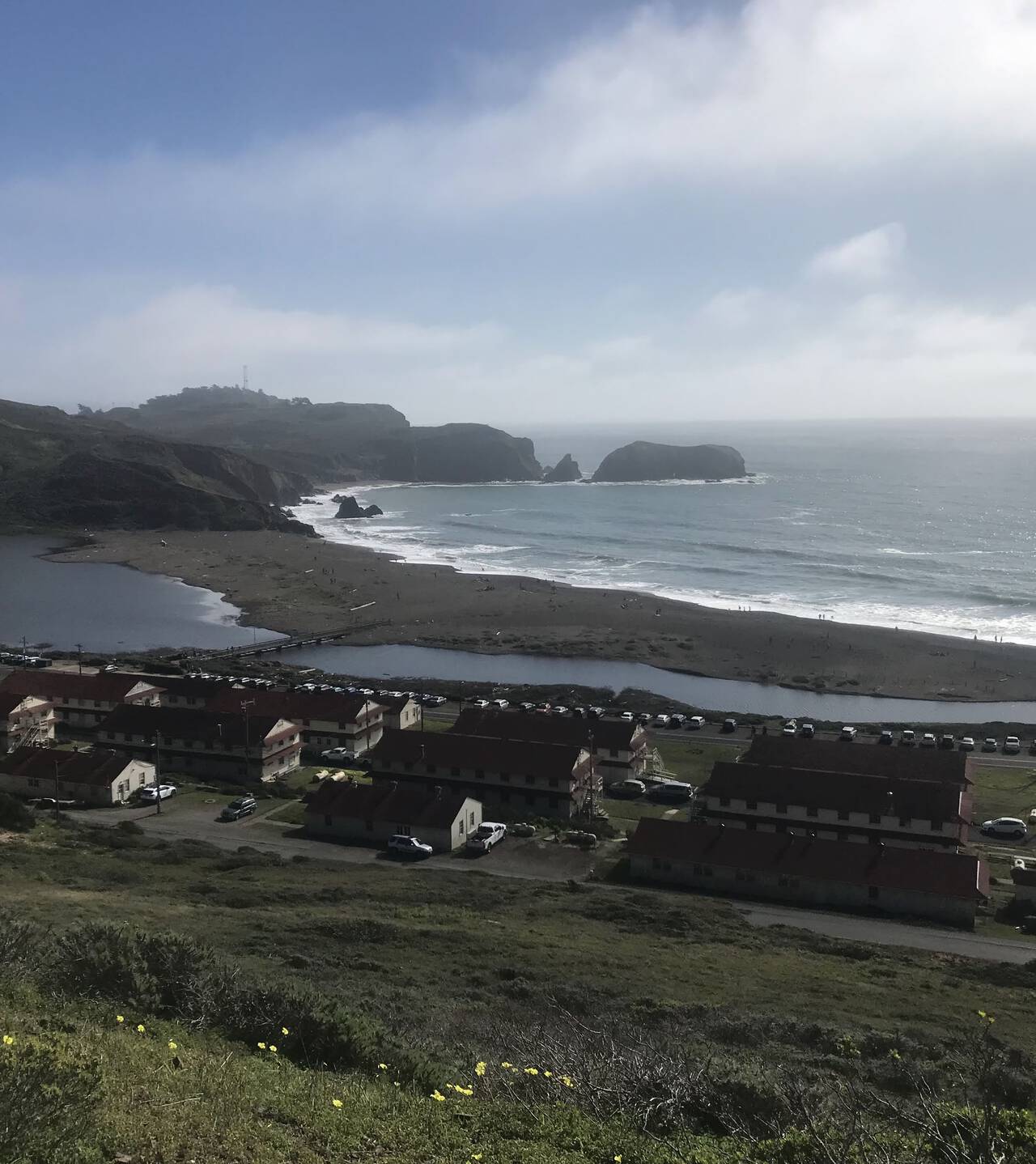
Rising out of Stinson Beach, the Dipsea trail is the site of the oldest trail race in America—though the race runs in the opposite direction, starting in Mill Valley. In contrast to the more rugged trails of Mount Tam, I quickly decided that the Dipsea trail's primary difficulty is that it's just so darned runnable.
There was significantly more foot traffic on the Dipsea trail than on the surrounding trails, though the Dipsea is not without enchanting moments.
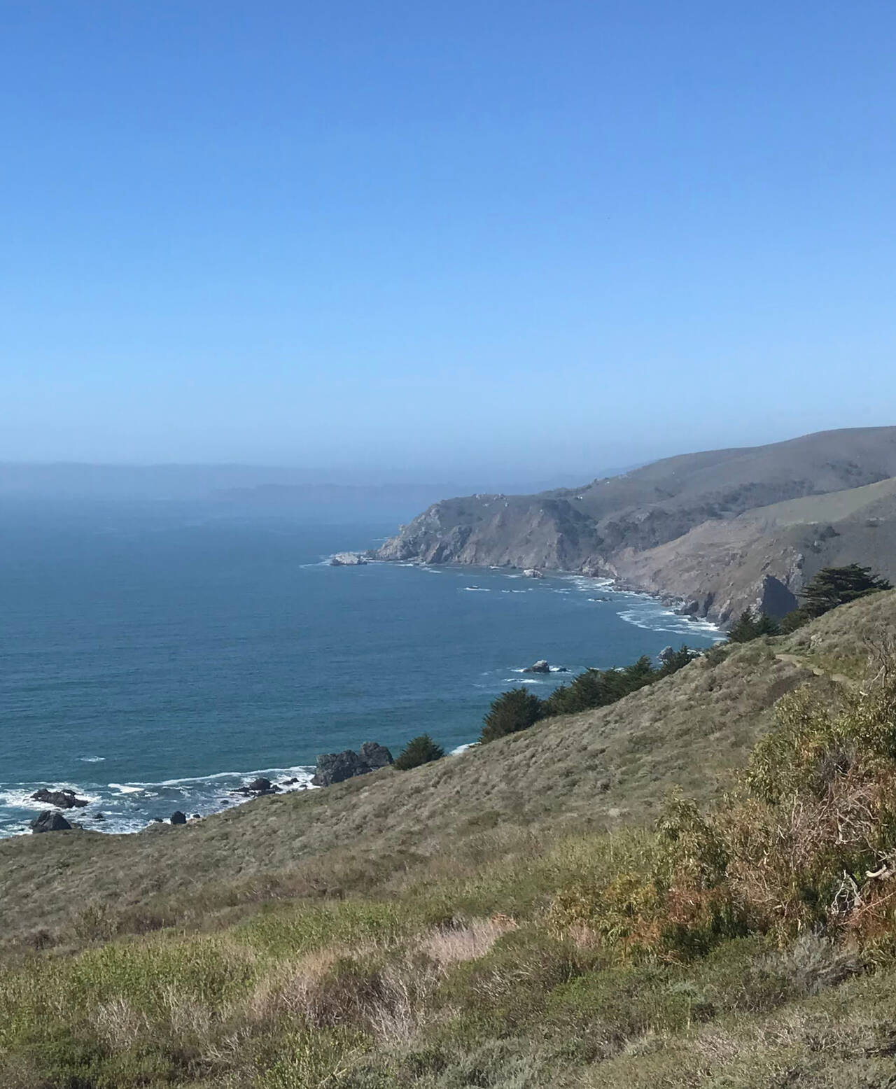
Just before the Dipsea trail descended to Muir Woods, I veered off toward the coast. The sun rose higher in the sky, but the three mile descent was smooth and forgiving and made for some of the most secluded, enjoyable running of the day.
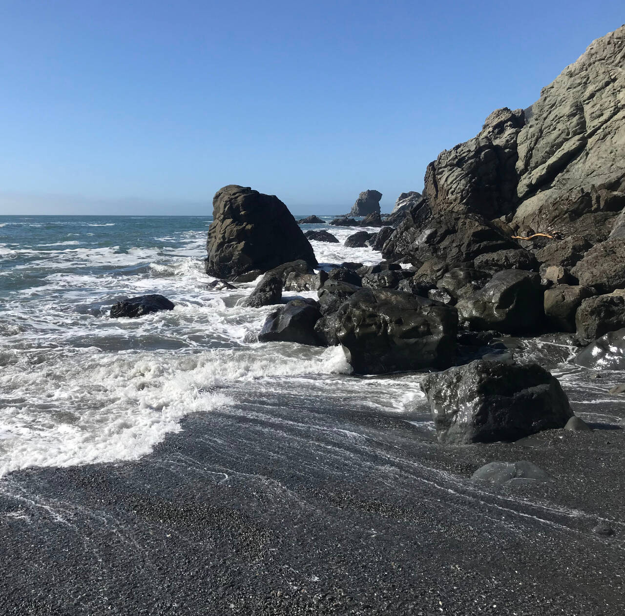
The final fifty meters down to Pirate's Cove wasn't strictly necessary, and as I ascended back to the trail in the intense sun, I felt immediate regret, bent over with hands on knees, and appreciated a moment of emptiness. This was The Wall.
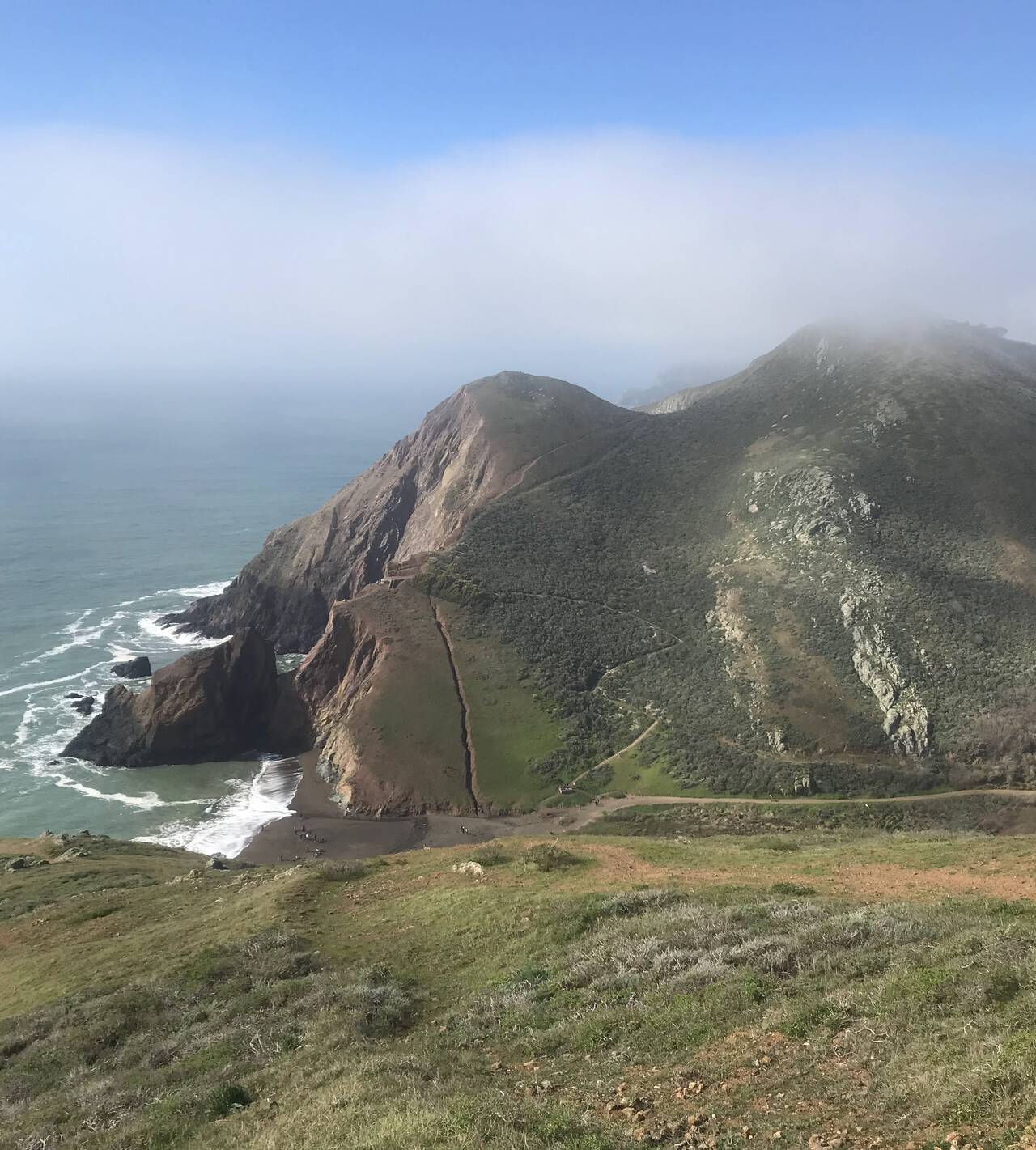
I paused for a moment as I climbed out of Tennessee Beach and saw that the sun-baked hill where I'd struggled to collect myself moments ago was already shrouded in fog.
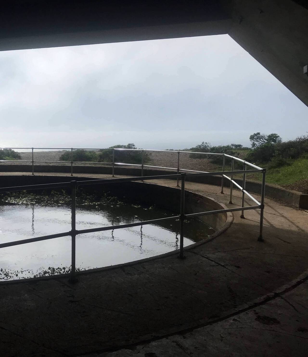
Tunnels and pillboxes made for an odd transition back to civilization. Top secret at the start of World War II, Battery Townsley is now just a military relic, though compared to the Nike Missile Sites scattered throughout the Bay Area, it's certainly not the most disconcerting.
I arrived at Rodeo Beach with sinking morale. When I get depleted on runs, my negative thoughts turn inward. Running is fundamentally a selfish pursuit, and seven hours on a trail gives you plenty of time to dwell on that thought. Even looking back, I mostly want to send a scenic snapshot to my family back home and file this run quietly away. In the best of moments though, running fills me with the sort of positive energy I think it's worthwhile to share without overanalyzing.
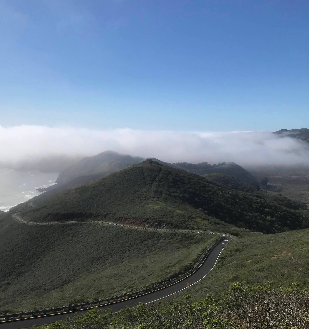
Having crested the emotional summit of the day, Hawk Hill was the physical summit. Without hills, I knew the remaining ten miles would be fine if not pleasant.
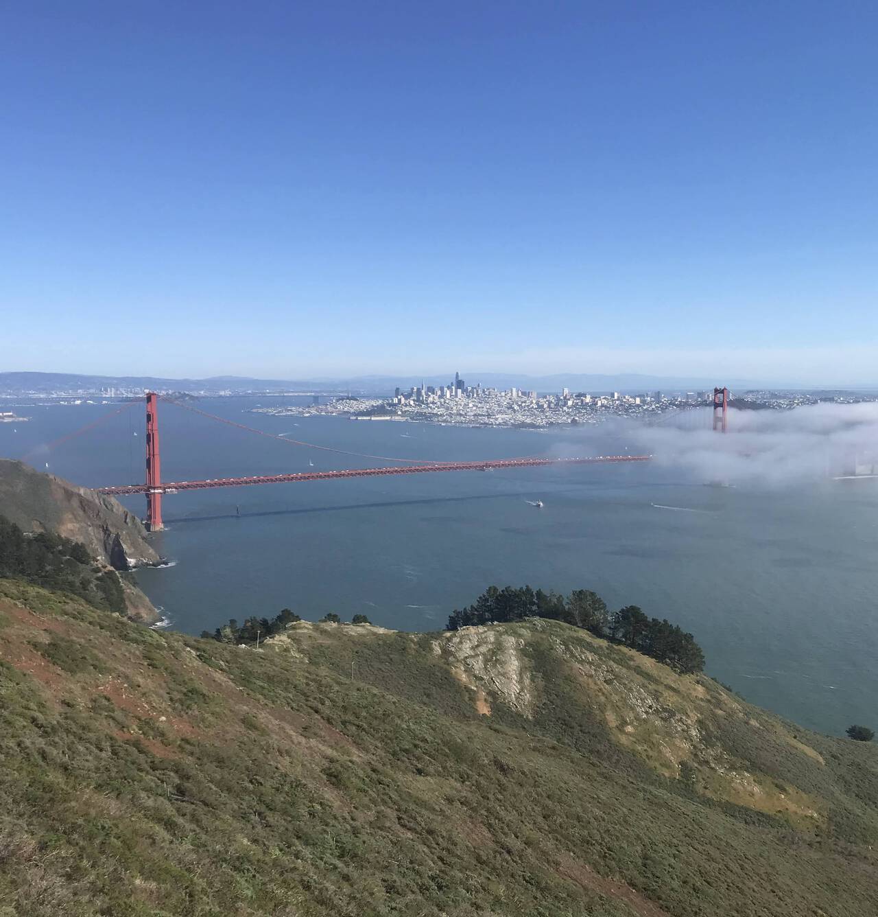
The Golden Gate Bridge was a more-than-welcome view as I crested the Marin Headlands.
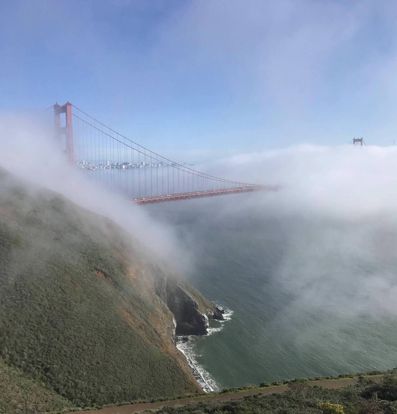
Even as I approached, the fog rolled in. With my phone battery hovering under 10% and our neighbor's Super Bowl party starting presently, I quit looking for photo opportunities, put my head down, and pushed forward.
I'd planned to look for a bus after crossing the Golden Gate Bridge, but making sense of buses seemed like either too much mental exertion or just too much of a change from the physical task I'd come to terms with.
Embarcadero
Arriving at just the right moment, I waited three minutes for a Richmond-bound BART, found a seat, and didn't even cramp up like I'd feared.
12th Street Oakland
I've not often been so satisfied with a run and so relieved to return home. My biggest regret was not putting on more sunscreen or perhaps bringing it with, though it did seem to have done its job, as I didn't end up with any discernible sunburn.
If I could do it all over again, the only change I'd have made would be to catch the very first bus of the day. The weather was perfect, though a bit warm. The distance was long but not insurmountable. Water fountains presented themselves at just the right time.
With one more hop and an extra twenty minutes of transit to Mill Valley, it would be perfectly possible to make a seven mile out-and-back day of Mount Tam via the Temelpa trail. Other options abound, particularly in the Marin Headlands near the Golden Gate Bridge. I do wish I'd had the energy to visit Point Bonita Lighthouse. There's even a bus to Stinson Beach.
Of course I can't recommend a forty mile route as that's a choice you would need to make for yourself, but from any single part of the route through entire thing or longer, it's more than worth devoting a day to it.
The Super Bowl was alright.